Toggle navigation
LMEC Home
Exhibitions
Georeferencing
Tools for Teachers
Collections
My Favorites
Sign Up / Log In
Search
Search the map portal
Map Collection
Map Collection
Map Sets
Search
Search
Search for
Search In
All Fields
Creator
Title
Subject
Place
Search All Digital Collections
Advanced Search
467 Results
My Search
Start Over
More Like
commonwealth:hx11xz975
Remove constraint More Like: commonwealth:hx11xz975
Filter your Search
Place
North and Central America
426
United States
305
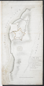
Canada
116
New England
94
Essex (county)
24
Massachusetts
23
New York
23
Saint Lawrence River
23
more
Place
»
Topic
New England--Maps--Early works to 1800
91
United States--History--French and Indian War, 1754-1763--Maps, Manuscript--Early works to 1800
58
Middle Atlantic States--Maps--Early works to 1800
20
Louisbourg (N.S.)--Maps, Manuscript--Early works to 1800
18
Fort Edward (N.Y.)--Maps, Manuscript--Early works to 1800
16
Fort Ticonderoga (N.Y.)--Maps, Manuscript--Early works to 1800
15
Saint Lawrence River--Maps, Manuscript--Early works to 1800
15
Louisbourg (N.S.)--History--Siege, 1745--Maps, Manuscript--Early works to 1800
14
more
Topic
»
Date
Date range begin
–
Date range end
Current results range from
1617
to
1999
View distribution
Creator
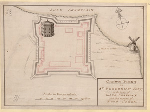
Royal United Services Institute for Defence and Security Studies
160
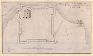
George, III, King of Great Britain, 1738-1820
152
George, IV, King of Great Britain, 1762-1830
151
Amherst, Jeffery Amherst, Baron, 1717-1797
130
Skinner, Monier
28
Skinner, William, 1700-1780
28
Brasier, William
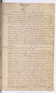
16
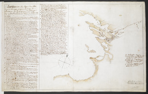
Bastide, John Henry, approximately 1700-1770
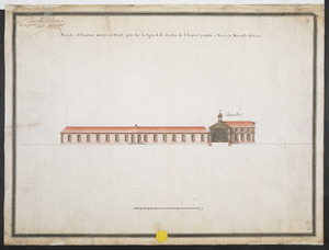
15
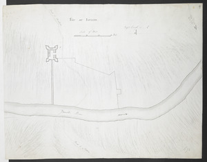
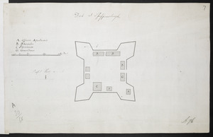
more
Creator
»
Format
Maps/Atlases
450
Manuscripts
151
Drawings/Illustrations
15
Georeferenced
Yes
15
No
452
Collection
American Revolutionary War-Era Maps
396
British Library Collection
376
Norman B. Leventhal Map Center Collection
62
Boston and New England Maps
51
Mapping Boston Collection
23
Sidney R. Knafel Map Collection at Phillips Academy
15
Maritime Charts and Atlases
12
Richard H. Brown Revolutionary War Map Collection at Mount Vernon
6
more
Collection
»
Available to use
Creative Commons license
410
No known restrictions
40
Search Constraints
Sort by title
relevance
title
date (asc)
date (desc)
Number of results to display per page
100 per page
10
per page
20
per page
50
per page
100
per page
View results as:
grid view
map view
Search Results
1.
1.r Plan du fort proposé dans l'Ille de S.t Simon pour la deffence de l'Entree du Havre de Jenkins Sownd
2.
1.r Plan du fort proposé dans l'Ille de S.t Simon pour la deffence de l'Entree du Havre de Jenkins Sownd
3.
1:st Position
4.
2:d Position
5.
2.e Plan d'une Batterie & d'une Redoute avec un Corps de Garde construit en forme de Redoute a Machecoulis pour y Servir de...
6.
3:d Position
7.
4:th Position
8.
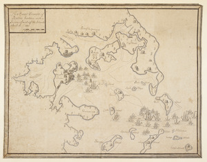
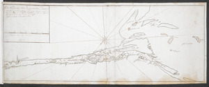
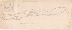
[A colored map of the route between Albany and Oswego; drawn about 1756, on a scale of 2 miles to an inch]
9.
[A coloured chart of the upper part of Lake Erie at Fort Erie and a detailed plan of Fort Erie, together with three cross...
10.
A= draught of Boston Harbor
11.
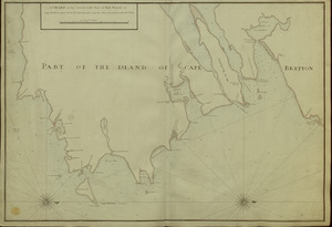
[A manuscript map of Isle Royalle]
12.
[A map of Fort Carillon and environs]
13.
[A map of Fort Carillon and environs]
14.
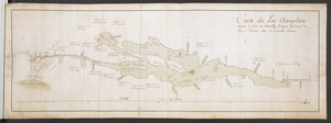
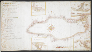
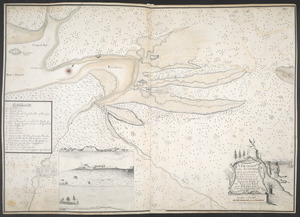
[A map of Lake Champlain and Lake George, showing the route from Fort Edward to Montreal]
15.
[A map of Lake Erie with the route southward from Fort Presqu'Isle to Fort Cumberland, with inset plans of Fort Pitt, Fort...
16.
[A map of Lake George from Fort William Henry to Ticonderoga]
17.
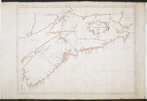
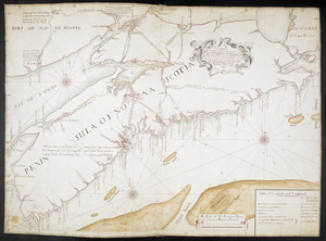
[A map of Nova Scotia showing the post roads]
18.
[A map of part of New York, comprehending the country between New York and Quebec, the river Connecticut, &c., to shew "the way...
19.
[A map of part of New York, comprehending the country between New York and Quebec, the river Connecticut, &c., to shew "the way...
20.
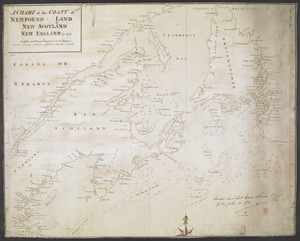
[A map of the east coast of America from Newfoundland to the Bay of Honduras]
21.
[A map of the River Schohary with a plan and elevation of the new fort]
22.
[A map of the southern part of the Lake Champlain, from "Tienderoga fort" to Crown Point]
23.
[A map showing the northern part of Lake George and Fort Ticonderoga]
24.
[A map showing the post route between the River St. Lawrence and the Bay of Fundy] : [on a scale of 5 1/3 miles to an inch.]
25.
[A map showing the post route between the River St. Lawrence and the Bay of Fundy] : [on a scale of 5 1/3 miles to an inch.]
26.
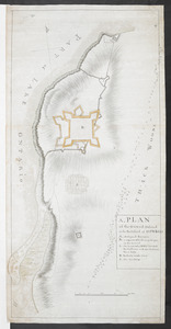
A, PLAN of the Ground Defined to be Fortified at OSWEGO
27.
A, PLAN of the Ground Defined to be Fortified at OSWEGO
28.
[A sketch map of the proposed battery (?) on Jekyll Island (?)]
29.
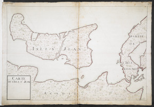
[Acadie, Isle Saint Jean and part of Isle Royale with the Baye Francoise]
30.
[Account of the action at Fort Niagara]
31.
An Accurate map of New Hampshire in New England, from a late survey
32.
An accurate map of Rhode Island, part of Connecticut and Massachusets, shewing Admiral Arbuthnot's station in blocking up...
33.
An accurate map of Rhode Island, part of Connecticut and Massachusets, shewing Admiral Arbuthnot's station in blocking up...
34.
An accurate map of the four New England states : shewing in a distinct manner all the mountains, forts, rivers, swamps,...
35.
An actual survey of the sea coast from New York to the I. Cape Brition : with tables of the direct and thwart courses &...
36.
[An outline plan of the harbour and fortifications of Louisbourg]
37.
[An unfinished chart of the Saint Lawrence River from Perrot Island to the Island of Orleans]
38.
Belgii Novi, Angliae Novae, et partis Virginiae : novissima delineatio
39.
Bowles's map of the seat of war in New England, comprehending the provinces of Massachusets Bay, and New Hampshire : with the...
40.
Bowles's new pocket map of the most inhabited part of New England : comprehending the provinces of Massachusets Bay and New...
41.
Bowles's new pocket map of the most inhabited part of New England : comprehending the provinces of Massachusets Bay and New...
42.
BOWLES'S NEW POCKET MAP OF THE UNITED STATES OF AMERICA : WITH THE BRITISH POSSESSIONS OF CANADA, NOVA SCOTIA, AND OF...
43.
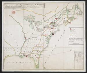
CANTONMENT of HIS MAJESTY'S FORCES in N. AMERICA ACCORDING TO THE DISPOSITION NOW MADE & TO BE COMPLETED AS SOON AS PRACTICABLE...
44.
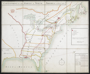
CANTONMENT OF THE FORCES IN NORTH AMERICA 11.th OCT.R 1765
45.
Carta particolare della nuoua Belgia è parte della nuoua Anglia
46.
Carte de la Nouvelle Angleterre, comprenant les etats de Massachusets Bay, N. Hamp Shire, Connecticut et Rhode Island
47.
Carte de la Nouvelle Angleterre, New York, Pensilvanie et Nouveau Jersay suivant les cartes angloises
48.
Carte de la Nouvelle Angleterre, Nouvelle Yorck, et Pensilvanie : pour servir à l'Histoire générale des voyages
49.
Carte de la Nouvelle Angleterre, Nouvelle York, Nouvelle Jersey et Pensilvanie
50.
CARTE de la RIVIERE de KATARAKOUI : du cote du nord, qui donne la Connoissance des Chutes, Cascades, Troux, rapides, et mauvais...
51.
CARTE DE L'ISLE ST JEAN
52.
CARTE DU COURS DE L'OHIO OU DE LA BELLE RIVIERE : Depuis sa Source jusqu'a sa Jonction avec celle d'Ouabache, avec les pays les...
53.
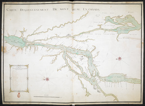
CARTE DU GOUVERNEMENT DE MONT REAL EN CANADA
54.
Carte du Lac Champlain depuis le Fort de Chambly Jusques au desus du Fort S.t Frederic, dans la Nouvelle France
55.
Carte Du Lac ontario nouvellement Rellevé avec ces port a grand pois a bitté Lescadre Engloisse & francoisse Leur gremant...
56.
Carte d'une partie de l'Amérique Septentrionale : pour servir à l'intellegence du mémoire sur les prétentions des Anglois...
57.
Carte generale du Canada ou Nouvelle France
58.
Carte Nouvellement Releve de La presantation a Frontenac : Nee Les Soude & moulliage cett Rivier Est for courant depuis Les...
59.
CARTE, ou plan Nouveau du Lac Ontario, avec touttes les isles et bayes qui y Sont rénfermées : Et les forts qui Sont Scitués...
60.
Carte réduite du nord des Etat-Unis avec l'intérieur du pays : pour servir à l'intelligence de cette histoire ; copieé par...
61.
[Charles Town Harbour & adjacent Islands, Country, Rivers &c]
62.
[Charles Town Neck Exhibiting the Plan of the Town and all the Fortifications in December 1781]
63.
Chart for the journal of Mr. le Mquis. de Chastellux
64.
A chart of the coast of America from New found Land to Cape Cod
65.
A chart of the coast of New England from the South Shoal to Cape Sable including Georges Bay from Holland & actual surveys
66.
A chart of the coast of New England from the South Shoal to Cape Sable including Georges Bay from Holland & actual surveys
67.
A CHART of the COAST OF NEWFOUND-LAND NEW SCOTLAND NEW ENGLAND &c. 1711
68.
A Chart of The Peninsula of Nova Scotia 1765
69.
[Chart of the Saint Lawrence River]
70.
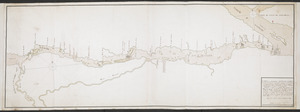
[Chart of the Saint Lawrence River from Anticosti to Quebec]
71.
A CHART OF THE SEA COASTS OF THE PENINSULA OF NOVA SCOTIA
72.
A CHART of the South East Part of l'Isle Royal, or Cape Bretton taken from the best Surveys, and the Observations of the most...
73.
The coast of New England
74.
[Coast of South Carolina, Georgia and Florida from Charleston to St. Augustine]
75.
[Coast of South Carolina, Georgia and Florida from Charleston to St. Augustine]
76.
A Copy of the Plan returned by his Maj:tys Com:rs for setling the Boundarys between the Provinces of New Hampshire and the...
77.
A correct map of the coast of New England
78.
A Correct Plan of the Province of New Hampshire together with part of Hudsons River from Albany to Lake George and from thence...
79.
COURS of ye ONONDAGA RIVER from ye three RIVERS to OSWEGO
80.
The Course of the Wood Creek from the Mowhock River at the Onoida or Great Carrying Place to The Onoida Lake. Representing the...
81.
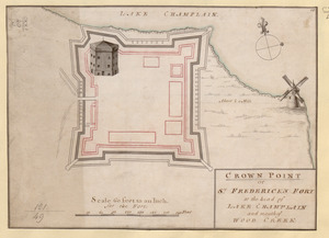
CROWN POINT or ST. FREDERICK'S FORT at the head of LAKE CHAMPLAIN and the Mouth of WOOD CREEK
82.
CROWN POINT or ST. FREDERICK'S FORT at the head of LAKE CHAMPLAIN and the Mouth of WOOD CREEK
83.
Crown Point or S.t Frederick's Fort at the Head of Lake Champlain and the Mouth of Wood Creek
84.
A DESCRIPTION OF THE TOWNE OF MANNADOS OR NEW AMSTERDAM as it was in September 1661 lying in Latitude 40 de: and 40,: Anno...
85.
Draught of a Scout over the Mountains West-ward of Lake Champlain
86.
A Draught of Lake George with all the Islands & Soundings
87.
A Draught of the Fortress building at Crown Point 22.d Oct.t 1759
88.
A DRAUGHT of the ISTHMUS which joyns Nova Scotia to the Continent with the Situation of the ENGLISH and FRENCH FORTS & the...
89.
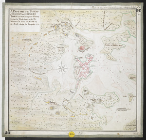
A DRAUGHT of the TOWNS of BOSTON and CHARLES TOWN and the Circumjacent Country shewing the Works thrown up by His MAJESTY'S...
90.
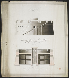
ELEVATION and SECTION of the TOWER at POINT PLEASANT
91.
[Entrance to the Harbour of S.t Johns Newfoundland]
92.
An Exact Draught of Bostone harbour, with a Survey of most of the Islands about it
93.
An exact map of New England, New York, Pensylvania & New Jersey, from the latest surveys
94.
Explanation of the Plans
95.
Explication d'un Esquis des Côtes depuis Oswego jusques a la Baye de Frontenac, et les environs des Isle qui Sont en...
96.
Façade, Elevation, Coupe et Profil, pris sur la ligne a.b. du plan de l'hopital projetté a Faire a la Nouvelle Orleans
97.
Fort at Carlisle
98.
FORT AT IUNIATA
99.
Fort at Shippensburgh
100.
Fort Augusta
‹ Prev
Next ›
1
2
3
4
5


![[A colored map of the route between Albany and Oswego; drawn about 1756, on a scale of 2 miles to an inch]](https://bpldcassets.blob.core.windows.net/derivatives/images/commonwealth:hx11z3223/image_thumbnail_300.jpg)
![[A coloured chart of the upper part of Lake Erie at Fort Erie and a detailed plan of Fort Erie, together with three cross sectional drawings]](https://bpldcassets.blob.core.windows.net/derivatives/images/commonwealth:hx11z482r/image_thumbnail_300.jpg)

![[A manuscript map of Isle Royalle]](https://bpldcassets.blob.core.windows.net/derivatives/images/commonwealth:hx11z507d/image_thumbnail_300.jpg)
![[A map of Fort Carillon and environs]](https://bpldcassets.blob.core.windows.net/derivatives/images/commonwealth:hx11z538d/image_thumbnail_300.jpg)
![[A map of Fort Carillon and environs]](https://bpldcassets.blob.core.windows.net/derivatives/images/commonwealth:hx11z342k/image_thumbnail_300.jpg)
![[A map of Lake Champlain and Lake George, showing the route from Fort Edward to Montreal]](https://bpldcassets.blob.core.windows.net/derivatives/images/commonwealth:hx11z3312/image_thumbnail_300.jpg)
![[A map of Lake Erie with the route southward from Fort Presqu'Isle to Fort Cumberland, with inset plans of Fort Pitt, Fort Venango, Fort Le Boeuf and Fort Presque Isle]](https://bpldcassets.blob.core.windows.net/derivatives/images/commonwealth:6108vw18h/image_thumbnail_300.jpg)
![[A map of Lake George from Fort William Henry to Ticonderoga]](https://bpldcassets.blob.core.windows.net/derivatives/images/commonwealth:hx11z3380/image_thumbnail_300.jpg)
![[A map of Nova Scotia showing the post roads]](https://bpldcassets.blob.core.windows.net/derivatives/images/commonwealth:hx11z494j/image_thumbnail_300.jpg)
![[A map of part of New York, comprehending the country between New York and Quebec, the river Connecticut, &c., to shew "the way from Albany to Canada ..... part by land and part by water;" drawn about 1720, on a scale of 31 miles to an inch]](https://bpldcassets.blob.core.windows.net/derivatives/images/commonwealth:6108vw070/image_thumbnail_300.jpg)
![[A map of part of New York, comprehending the country between New York and Quebec, the river Connecticut, &c., to shew "the way from Albany to Canada ..... part by land and part by water;" drawn about 1720, on a scale of 31 miles to an inch]](https://bpldcassets.blob.core.windows.net/derivatives/images/commonwealth:6108vw09j/image_thumbnail_300.jpg)
![[A map of the east coast of America from Newfoundland to the Bay of Honduras]](https://bpldcassets.blob.core.windows.net/derivatives/images/commonwealth:hx11z584h/image_thumbnail_300.jpg)
![[A map of the River Schohary with a plan and elevation of the new fort]](https://bpldcassets.blob.core.windows.net/derivatives/images/commonwealth:hx11z356x/image_thumbnail_300.jpg)
![[A map of the southern part of the Lake Champlain, from "Tienderoga fort" to Crown Point]](https://bpldcassets.blob.core.windows.net/derivatives/images/commonwealth:6108vv78r/image_thumbnail_300.jpg)
![[A map showing the northern part of Lake George and Fort Ticonderoga]](https://bpldcassets.blob.core.windows.net/derivatives/images/commonwealth:hx11z3444/image_thumbnail_300.jpg)
![[A map showing the post route between the River St. Lawrence and the Bay of Fundy]](https://bpldcassets.blob.core.windows.net/derivatives/images/commonwealth:hx11z4963/image_thumbnail_300.jpg)
![[A map showing the post route between the River St. Lawrence and the Bay of Fundy]](https://bpldcassets.blob.core.windows.net/derivatives/images/commonwealth:hx11z498n/image_thumbnail_300.jpg)
![[A sketch map of the proposed battery (?) on Jekyll Island (?)]](https://bpldcassets.blob.core.windows.net/derivatives/images/commonwealth:hx11z460q/image_thumbnail_300.jpg)
![[Acadie, Isle Saint Jean and part of Isle Royale with the Baye Francoise]](https://bpldcassets.blob.core.windows.net/derivatives/images/commonwealth:hx11z490f/image_thumbnail_300.jpg)
![[Account of the action at Fort Niagara]](https://bpldcassets.blob.core.windows.net/derivatives/images/commonwealth:6108vv66z/image_thumbnail_300.jpg)


![[An outline plan of the harbour and fortifications of Louisbourg]](https://bpldcassets.blob.core.windows.net/derivatives/images/commonwealth:hx11z5128/image_thumbnail_300.jpg)
![[An unfinished chart of the Saint Lawrence River from Perrot Island to the Island of Orleans]](https://bpldcassets.blob.core.windows.net/derivatives/images/commonwealth:hx11z0836/image_thumbnail_300.jpg)


![[Charles Town Harbour & adjacent Islands, Country, Rivers &c]](https://bpldcassets.blob.core.windows.net/derivatives/images/commonwealth:hx11z271t/image_thumbnail_300.jpg)
![[Charles Town Neck Exhibiting the Plan of the Town and all the Fortifications in December 1781]](https://bpldcassets.blob.core.windows.net/derivatives/images/commonwealth:hx11z273c/image_thumbnail_300.jpg)


![[Chart of the Saint Lawrence River]](https://bpldcassets.blob.core.windows.net/derivatives/images/commonwealth:hx11z0594/image_thumbnail_300.jpg)
![[Chart of the Saint Lawrence River from Anticosti to Quebec]](https://bpldcassets.blob.core.windows.net/derivatives/images/commonwealth:hx11z079m/image_thumbnail_300.jpg)

![[Coast of South Carolina, Georgia and Florida from Charleston to St. Augustine]](https://bpldcassets.blob.core.windows.net/derivatives/images/commonwealth:hx11z448f/image_thumbnail_300.jpg)
![[Coast of South Carolina, Georgia and Florida from Charleston to St. Augustine]](https://bpldcassets.blob.core.windows.net/derivatives/images/commonwealth:hx11z450g/image_thumbnail_300.jpg)


![[Entrance to the Harbour of S.t Johns Newfoundland]](https://bpldcassets.blob.core.windows.net/derivatives/images/commonwealth:6108vv35z/image_thumbnail_300.jpg)