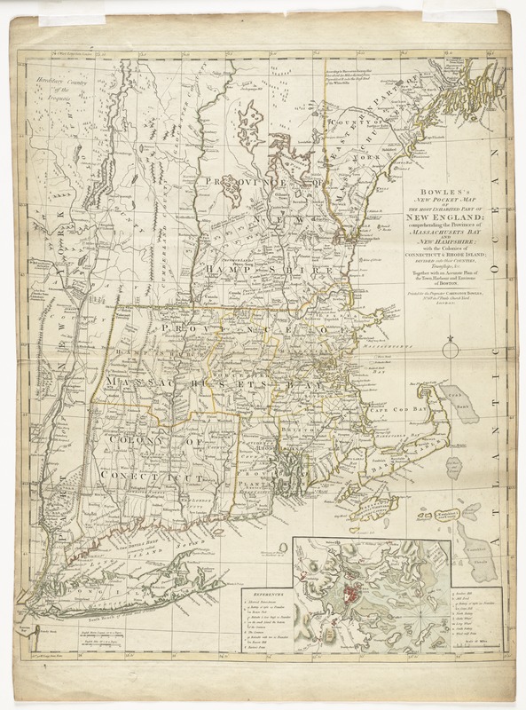
Bowles's new pocket map of the most inhabited part of New England : comprehending the provinces of Massachusets Bay and New Hampshire; with the colonies of Connecticut & Rhode Island; divided into their counties, townships, &c. together with an accurate plan of the town, harbour and environs of Boston
This map is also available in American Revolutionary Geographies Online (ARGO), a collections portal especially built for material relating to the American Revolutionary War Era. Visit ARGO to learn more about this item and explore the historical geography of North America in the late eighteenth century.
Item Information
- Title:
- Bowles's new pocket map of the most inhabited part of New England : comprehending the provinces of Massachusets Bay and New Hampshire; with the colonies of Connecticut & Rhode Island; divided into their counties, townships, &c. together with an accurate plan of the town, harbour and environs of Boston
- Creator:
- Bowles, Carington, 1724-1793
- Date:
-
[1776?]
- Format:
-
Maps/Atlases
- Location:
- Phillips Academy
- Collection (local):
-
Sidney R. Knafel Map Collection at Phillips Academy, Andover MA
- Subjects:
-
New England--Maps--Early works to 1800
Massachusetts--History--Revolution, 1775-1783--Maps--Early works to 1800
- Places:
-
New England (area)
Massachusetts
- Extent:
- 1 map : hand colored ; 62 x 52 cm.
- Terms of Use:
-
Rights status not evaluated.
Contact host institution for more information.
- Publisher:
-
London :
Carington Bowles
- Scale:
-
Scale [ca. 1:800,000]
- Language:
-
English
- Notes:
-
Relief shown pictorially.
Prime meridians: London and Ferro.
Inset: Plan of Boston with its harbour and environs.
Inset includes references to batteries and points of interest.
4th state, with title on the right and Vermont not identified.
- Notes (citation):
-
Stevens & Tree. Comparative cartography, 32e
- Identifier:
-
1350


