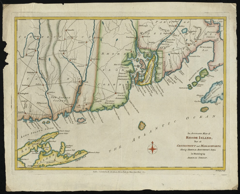
An accurate map of Rhode Island, part of Connecticut and Massachusets, shewing Admiral Arbuthnot's station in blocking up Admiral Ternay
This map is also available in American Revolutionary Geographies Online (ARGO), a collections portal especially built for material relating to the American Revolutionary War Era. Visit ARGO to learn more about this item and explore the historical geography of North America in the late eighteenth century.
Item Information
- Title:
- An accurate map of Rhode Island, part of Connecticut and Massachusets, shewing Admiral Arbuthnot's station in blocking up Admiral Ternay
- Creator:
- Lodge, John, -1796
- Contributor:
- Bew, John, -1793
- Name on Item:
-
Jno. Lodge sculp.
- Date:
-
1780
- Format:
-
Maps/Atlases
- Location:
- Phillips Academy
- Collection (local):
-
Sidney R. Knafel Map Collection at Phillips Academy, Andover MA
- Subjects:
-
New England--Maps--Early works to 1800
Connecticut--Maps--Early works to 1800
Rhode Island--Maps--Early works to 1800
Massachusetts--Maps--Early works to 1800
United States--History--Revolution, 1775-1783--Naval operations--Maps
- Places:
-
New England (area)
Connecticut
Rhode Island
Massachusetts
- Extent:
- 1 map : hand col. ; 26 x 37 cm.
- Terms of Use:
-
Rights status not evaluated.
Contact host institution for more information.
- Publisher:
-
London :
J. Bew
- Scale:
-
Scale [ca. 1:484,000]
- Language:
-
English
- Notes:
-
Covers Rhode Island, the eastern half of Connecticut, southeastern Massachusetts as far east as Falmouth and Martha's Vineyard, and eastern Long Island.
Relief shown pictorially.
Prime meridian: Ferro; incorrectly marked "London" on map.
- Identifier:
-
1367
- Call #:
-
Map 60.6.M5.1780


