Toggle navigation
LMEC Home
Exhibitions
Georeferencing
Tools for Teachers
Collections
My Favorites
Sign Up / Log In
Search
Search the map portal
Map Collection
Map Collection
Map Sets
Search
Collections of Distinction
1.
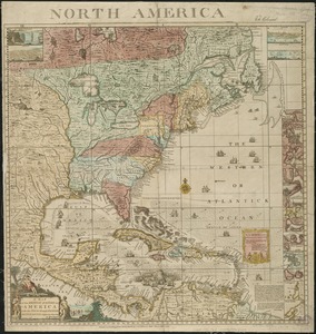
American Revolutionary War-Era Maps
2.
Boston and New England Maps
3.
Maritime Charts and Atlases
4.
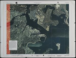
Urban Maps
Digital Partner Collections
1.
American Antiquarian Society Collection
2.
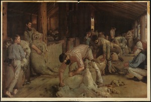
American Textile History Museum Image Collection
3.
Applied Geographics, Inc. Records
4.
Boston Athenaeum, Cartographic Collection
5.
Boston Redevelopment Authority Collection
6.
British Library Collection
7.
Campus Maps from Phillips Academy Archives and Special Collections
8.
David Judkins Weaver Papers
9.
Harvard Map Collection
10.
Library and Archives Canada Collection
11.
Library of Congress Collection
12.
Lucius Beebe Memorial Library Historic Maps
13.
MacLean Collection Map Library
14.
Map Collections at Phillips Academy
15.
Mapping Boston Collection
16.
Mapping Inequality Collection
17.
Massachusetts Historical Society Map Collection
18.
Massachusetts Real Estate Atlases
19.
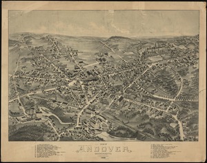
Methuen Historic Collection
20.
National Archives and Records Administration Collection
21.
New York Public Library Collection
22.
Newberry Library Collection
23.
New-York Historical Society Collection
24.
Norman B. Leventhal Map & Education Center Collection
25.
Pechter Family Map Collection at Phillips Academy
26.
Ralph Finos Map Collection at Phillips Academy
27.
Richard H. Brown Revolutionary War Map Collection at Mount Vernon
28.
Robert E. Diefenbach Map Collection at Phillips Academy
29.
Sidney R. Knafel Map Collection at Phillips Academy
30.
Town plans, 1794
31.
Town plans, 1830
32.
Urban Renewal and Redevelopment Collection, 1949-1977
33.
U.S. Government Documents Maps Collection
34.
William L. Clements Library Collection