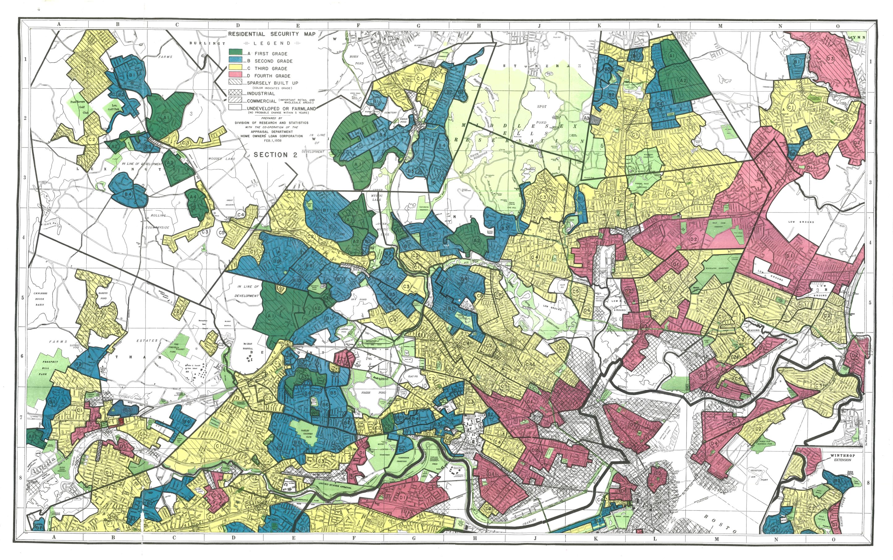
This collection consists of residential security maps (also known as redlining maps) of New England cities created by the Home Owners' Loan Corporation (HOLC). Images are from Mapping Inequality at the Digital Scholarship Lab at University of Richmond.
HOLC was a federal agency established in 1933 to provide mortgage assistance to homeowners or would-be homeowners through loans or refinancing mortgages. To determine where to make loans, HOLC evaluated areas based on multiple factors, the most impactful of which were the racial and ethnic identity and class of residents. Areas with African Americans, immigrants, and working-class whites were judged as having lower economic value and less safe to invest in. HOLC created residential security maps that were colored to show grades of "mortgage security". The safest areas for investment were green while the most "hazardous" areas were red.
As a result of HOLC assessments, people in areas with lower grades were less likely to receive loans and mortgage assistance. These discriminatory practices in lending contributed to racial residential segregation, the wealth gap and urban decay in the United States.
See the Mapping Inequality site for interactive maps, area descriptions, and maps of other cities.