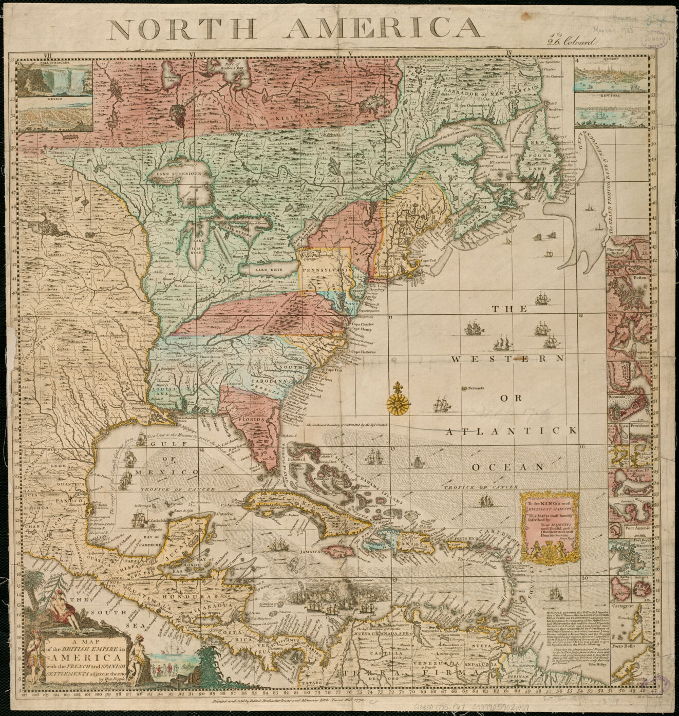
With the first battles of the American Revolution occurring in the Boston area, one of the most important historical time periods represented in the Norman B. Leventhal Map Center's pre-20th-century holdings is the American Revolutionary War era, defined broadly as 1750 to 1800. This collection encompasses approximately 900 maps covering Boston and New England, as well as the remainder of eastern North America and the West Indies during this time period.
While these maps highlight Boston's role in the Revolution, they also document the crucial events that led from the French and Indian War to the War of Independence and on to the formation of a new nation during the last decade of the 18th century. In doing so, they provide basic graphic resources for researching North America's historical geography by mapping and reconstructing settlement and cultural landscapes that gave each colony its identity and character. The maps portraying the period before the war provide the geographical basis for understanding the role of the 13 colonies within the wider context of the British Empire and its relationships with its European neighbors and competitors.
Building upon this Collection of Distinction, the Map Center has developed the American Revolution Portal, which is a curated digital collection of maps related to the American Revolutionary War era, broadly defined as maps of the eastern part of North America and the West Indies dated 1750-1800. The Portal is designed to provide digital access to a wide-ranging selection of the finest and most informative manuscript and printed maps from public and private collections in the United States and Great Britain. More than 2,000 maps, including selections from the partners listed below, are currently available in the Portal.
Partner Collections
- American Antiquarian Society Collection
- Boston Athenæum Collection
- British Library Collection
- Harvard Map Collection
- Library of Congress Collection
- Massachusetts Historical Society Map Collection
- New York Public Library Collection
- Newberry Library Collection
- New-York Historical Society Collection
- Richard H. Brown Revolutionary War Map Collection
- Sidney R. Knafel Collection at Phillips Academy
- Library and Archives Canada Collection
- MacLean Collection Map Library Collection
- William L. Clements Library Collection