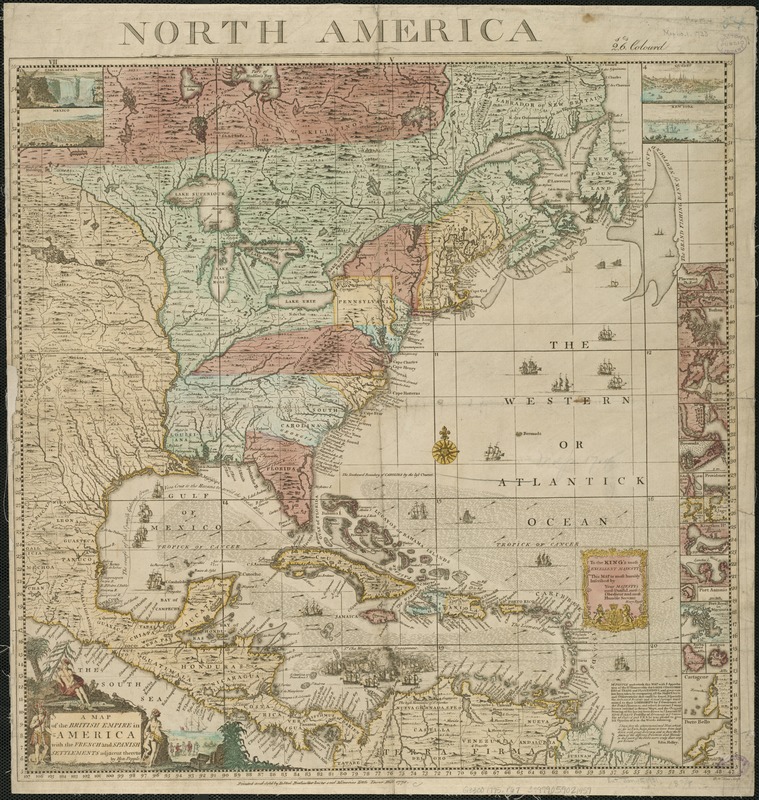
A map of the British Empire in America with the French and Spanish settlements adjacent thereto
This map is also available in American Revolutionary Geographies Online (ARGO), a collections portal especially built for material relating to the American Revolutionary War Era. Visit ARGO to learn more about this item and explore the historical geography of North America in the late eighteenth century.
Item Information
- Title:
- A map of the British Empire in America with the French and Spanish settlements adjacent thereto
- Creator:
- Popple, Henry, d. 1743
- Name on Item:
-
by Hen. Popple ; W.H. Toms, sculp.
- Date:
-
1775
- Format:
-
Maps/Atlases
- Location:
-
Boston Public Library
Norman B. Leventhal Map & Education Center - Collection (local):
-
Norman B. Leventhal Map & Education Center Collection
- Subjects:
-
North America--Maps--Early works to 1800
- Places:
-
North America (area)
- Extent:
- 1 map ; 48 x 48 cm.
- Terms of Use:
-
No known copyright restrictions.
No known restrictions on use.
- Publisher:
-
London :
Printed and sold by D. Steel
- Scale:
-
Scale ca. 1:11,750,000.
- Language:
-
English
- Notes:
-
Originally published in 1733 as index to Popple's atlas.
Relief shown pictorially.
- Identifier:
-
06_01_006219
- Call #:
-
G3300 1775 .P67
- Barcode:
-
39999059021459


