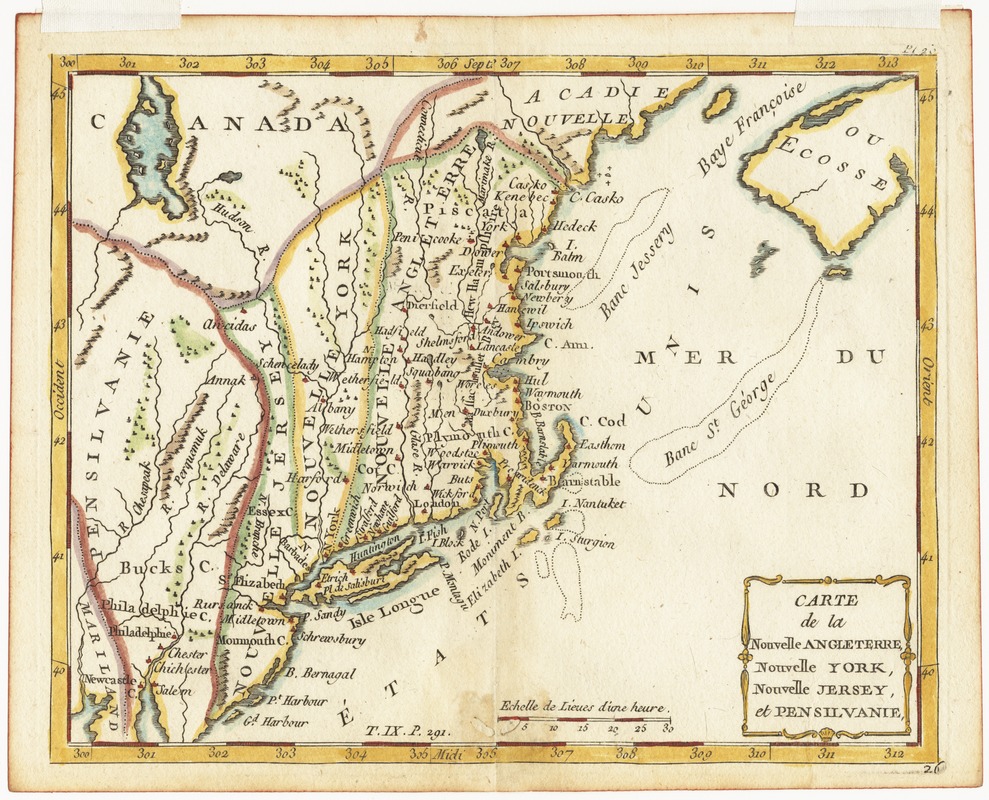
Carte de la Nouvelle Angleterre, Nouvelle York, Nouvelle Jersey et Pensilvanie
This map is also available in American Revolutionary Geographies Online (ARGO), a collections portal especially built for material relating to the American Revolutionary War Era. Visit ARGO to learn more about this item and explore the historical geography of North America in the late eighteenth century.
Item Information
- Title:
- Carte de la Nouvelle Angleterre, Nouvelle York, Nouvelle Jersey et Pensilvanie
- Creator:
- Laporte, Joseph de, 1713-1779
- Date:
-
[1786?]
- Format:
-
Maps/Atlases
- Location:
- Phillips Academy
- Collection (local):
-
Sidney R. Knafel Map Collection at Phillips Academy, Andover MA
- Subjects:
-
New England--Maps--Early works to 1800
Middle Atlantic States--Maps--Early works to 1800
- Places:
-
New England (area)
Middle Atlantic (area)
- Extent:
- 1 map : hand col. ; 17 x 22 cm.
- Terms of Use:
-
Rights status not evaluated.
Contact host institution for more information.
- Publisher:
-
[Paris] :
[Laporte]
- Scale:
-
Scale [ca. 1:4,000,000]
- Language:
-
French
- Notes:
-
Relief shown pictorially.
Prime meridian: Paris.
At bottom of map: T. IX. p. 291.
From Laporte's Atlas moderne portatif (Paris : Laporte, 1786?].
Identified as "Etats Unis" on eastern coast.
- Notes (citation):
-
McCorkle, B. New England in early printed maps, 780.2
- Identifier:
-
1369


