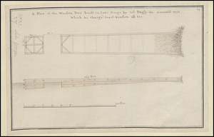
[A map showing the northern part of Lake George and Fort Ticonderoga]
![[A map showing the northern part of Lake George and Fort Ticonderoga]](https://bpldcassets.blob.core.windows.net/derivatives/images/commonwealth:hx11z3444/image_access_800.jpg)
This map is also available in American Revolutionary Geographies Online (ARGO), a collections portal especially built for material relating to the American Revolutionary War Era. Visit ARGO to learn more about this item and explore the historical geography of North America in the late eighteenth century.
Item Information
- Title:
- [A map showing the northern part of Lake George and Fort Ticonderoga]
- Former owner:
- George, III, King of Great Britain, 1738-1820
- Donor:
- George, IV, King of Great Britain, 1762-1830
- Date:
-
1756
- Format:
-
Maps/Atlases
Manuscripts
- Location:
- British Library
- Collection (local):
-
British Library Collection
- Subjects:
-
Military art and science--New York (State)--George, Lake (Lake)--Maps, Manuscript--Early works to 1800
George, Lake (N.Y. : Lake)--Maps, Manuscript--Early works to 1800
Fort Ticonderoga (N.Y.)--Maps, Manuscript--Early works to 1800
United States--History--French and Indian War, 1754-1763--Maps, Manuscript--Early works to 1800
- Places:
-
George, Lake
Essex (county)Fort Ticonderoga (transport point)
- Extent:
- 1 map : manuscript pen and ink with watercolour over pencil ; 35 x 30 cm
- Terms of Use:
-
No known copyright restrictions.
This work is licensed for use under a Creative Commons Attribution Non-Commercial Share Alike License (CC BY-NC-SA).

- Scale:
-
Scale not given
- Language:
-
English
- Catalog Record:
-
http://explore.bl.uk/BLVU1:LSCOP-ALL:BLL01004987772
- Notes:
-
A date of about 1756 is attributed in previous British Library cataloguing and because the map shows Fort Ticonderoga (or Fort Carillon) before the 1758 Battle of Carillon.
Relief is shown by shading.
Fort Ticonderoga is named "Ticonde".
The "Advanced Guard" is marked at the entrance to The Narrows on Lake George.
Shows a saw mill.
A directional pointer surmounted by a fleur de lys orients north to the top of the map.
Compare with another map from the King's Topographical Collection in a similar hand (Maps K.Top.121.22.).
Titled "A drawn Plan of the Northern part of Lake George" in the Catalogue of Maps, Prints, Drawings, etc., forming the geographical and topographical collection attached to the Library of his late Majesty King George the third, etc., London, 1829.
Titled "A survey of the country between the upper part of Lake George and Fort Ticonderoga; drawn about 1756: 1 f. 2 in. x 1 f." in the Catalogue of the manuscript maps, charts, and plans, and of the topographical drawings in the British Museum.

![[A map of Fort Carillon and environs]](https://bpldcassets.blob.core.windows.net/derivatives/images/commonwealth:hx11z538d/image_thumbnail_300.jpg)
![[A map of Fort Carillon and environs]](https://bpldcassets.blob.core.windows.net/derivatives/images/commonwealth:hx11z342k/image_thumbnail_300.jpg)
![[A map of Lake George from Fort William Henry to Ticonderoga]](https://bpldcassets.blob.core.windows.net/derivatives/images/commonwealth:hx11z3380/image_thumbnail_300.jpg)
