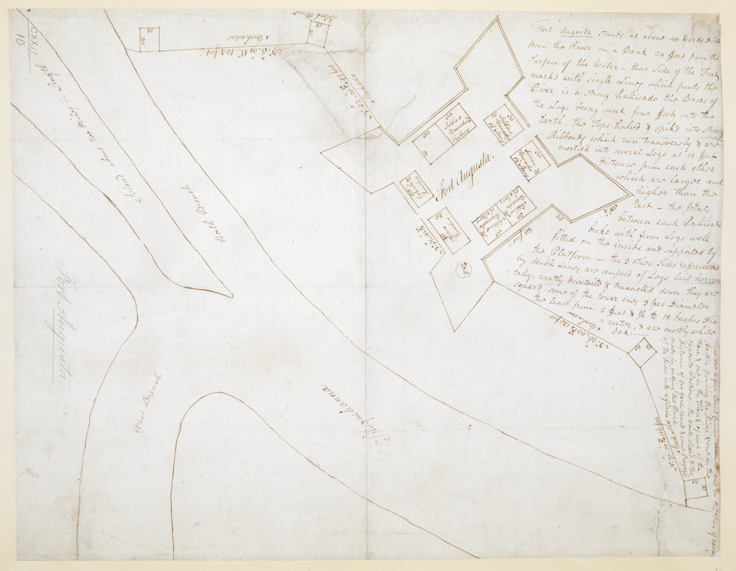
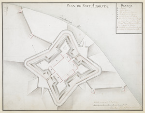
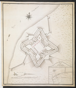
Fort Augusta
This map is also available in American Revolutionary Geographies Online (ARGO), a collections portal especially built for material relating to the American Revolutionary War Era. Visit ARGO to learn more about this item and explore the historical geography of North America in the late eighteenth century.
Item Information
- Title:
- Fort Augusta
- Title (alt.):
-
Plan of Fort Augusta as first intended
- Former owner:
- George, III, King of Great Britain, 1738-1820
- Donor:
- George, IV, King of Great Britain, 1762-1830
- Date:
-
[1756?]
- Format:
-
Maps/Atlases
Manuscripts
- Location:
- British Library
- Collection (local):
-
British Library Collection
- Subjects:
-
Fort Augusta (Pa.)--Maps, Manuscript--Early works to 1800
Sunbury (Pa.)--Maps, Manuscript--Early works to 1800
United States--History--French and Indian War, 1754-1763--Maps, Manuscript--Early works to 1800
- Places:
-
Northumberland (county)Sunbury
- Extent:
- 1 map : manuscript pen and ink ; 32 x 42 cm
- Terms of Use:
-
No known copyright restrictions.
This work is licensed for use under a Creative Commons Attribution Non-Commercial Share Alike License (CC BY-NC-SA).

- Scale:
-
Scale approximately 1:528
- Language:
-
English
- Catalog Record:
-
http://explore.bl.uk/BLVU1:LSCOP-ALL:BLL01004987650
- Notes:
-
Includes a descriptive text of the fort and its location at upper right.
Shows measurements of individual barracks within the fort.
Shows latitudinal positions for defences outside the fort.
Shows a well within the fort.
Varying title to map's verso.
Titled "A drawn Plan of Fort Augusta in the Susquehanna Riv." in the Catalogue of Maps, Prints, Drawings, etc., forming the geographical and topographical collection attached to the Library of his late Majesty King George the third, etc., London, 1829.
Titled "A plan of Fort Augusta, on the Susquehanna river, at the junction of the north and west branches; drawn about 1756, on a scale of about 40 feet to an inch: 1 f. 4 in. x 1 f. 1 in." in the Catalogue of the manuscript maps, charts, and plans, and of the topographical drawings in the British Museum.

![[A colored map of the route between Albany and Oswego; drawn about 1756, on a scale of 2 miles to an inch]](https://bpldcassets.blob.core.windows.net/derivatives/images/commonwealth:hx11z3223/image_thumbnail_300.jpg)
![[A map of Fort Carillon and environs]](https://bpldcassets.blob.core.windows.net/derivatives/images/commonwealth:hx11z538d/image_thumbnail_300.jpg)
