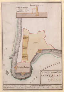
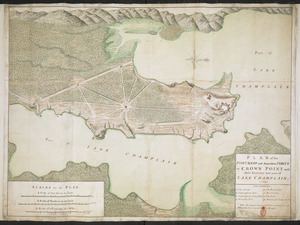
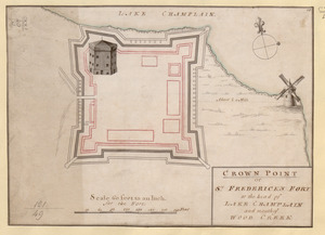
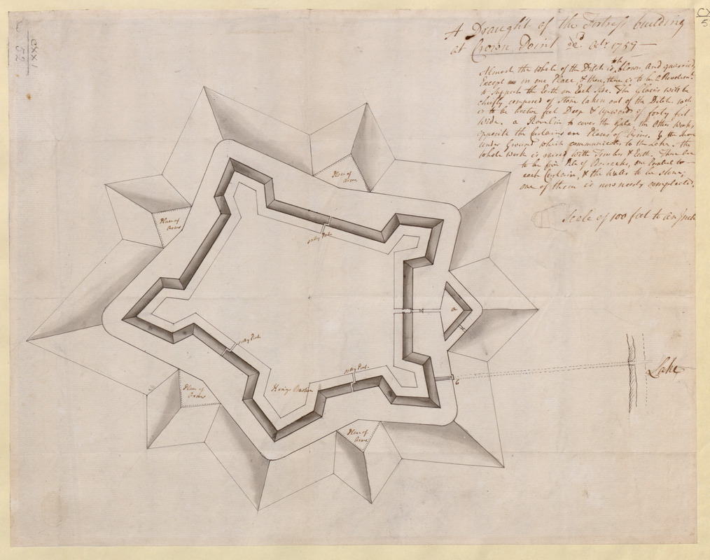
A Draught of the Fortress building at Crown Point 22.d Oct.t 1759
This map is also available in American Revolutionary Geographies Online (ARGO), a collections portal especially built for material relating to the American Revolutionary War Era. Visit ARGO to learn more about this item and explore the historical geography of North America in the late eighteenth century.
Item Information
- Title:
- A Draught of the Fortress building at Crown Point 22.d Oct.t 1759
- Former owner:
- George, III, King of Great Britain, 1738-1820
- Donor:
- George, IV, King of Great Britain, 1762-1830
- Date:
-
1759
- Format:
-
Maps/Atlases
Manuscripts
- Location:
- British Library
- Collection (local):
-
British Library Collection
- Subjects:
-
Fortification--New York (State)--Crown Point--Maps, Manuscript--Early works to 1800
Military art and science--New York (State)--Crown Point--Maps, Manuscript--Early works to 1800
Crown Point (N.Y.)--Maps, Manuscript--Early works to 1800
United States--History--French and Indian War, 1754-1763--Maps, Manuscript--Early works to 1800
- Places:
-
Essex (county)Crown Point (cape)
- Extent:
- 1 map : manuscript pen and ink with watercolour (grayscale) over pencil ; 34 x 44 cm
- Terms of Use:
-
No known copyright restrictions.
This work is licensed for use under a Creative Commons Attribution Non-Commercial Share Alike License (CC BY-NC-SA).

- Scale:
-
Scale 1:1,200
- Language:
-
English
- Catalog Record:
-
http://explore.bl.uk/BLVU1:LSCOP-ALL:BLL01004987785
- Notes:
-
Title at upper right is followed by text describing the construction of the fort; "Almost the Whole of the Ditch is to be blown and quarried, Except in one Place ...
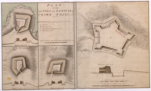
Labels on the map identify "sally port", "place of arms" and the "King's Bastion".
Photostatic reproduction is in Archer Butler Hulbert's "The Crown Collection of photographs of American maps" at the Newberry Library in Chicago - Call Number: folio Ayer 136 .H91 1907 ser. 1, v. 4, pl. 1 (PrCt).
Titled "A draught of the Fortress building at crown Point, 22 Oct. 1759" in the Catalogue of Maps, Prints, Drawings, etc., forming the geographical and topographical collection attached to the Library of his late Majesty King George the third, etc., London, 1829.
Titled "A draught of the Fortress building at Crown Point, 22 Oct., 1759;" drawn on a scale of 100 feet to an inch: 1 f. 6 in. x 1 f. 2 in." in the Catalogue of the manuscript maps, charts, and plans, and of the topographical drawings in the British Museum.