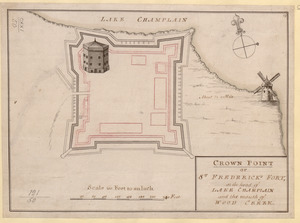
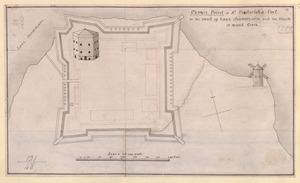
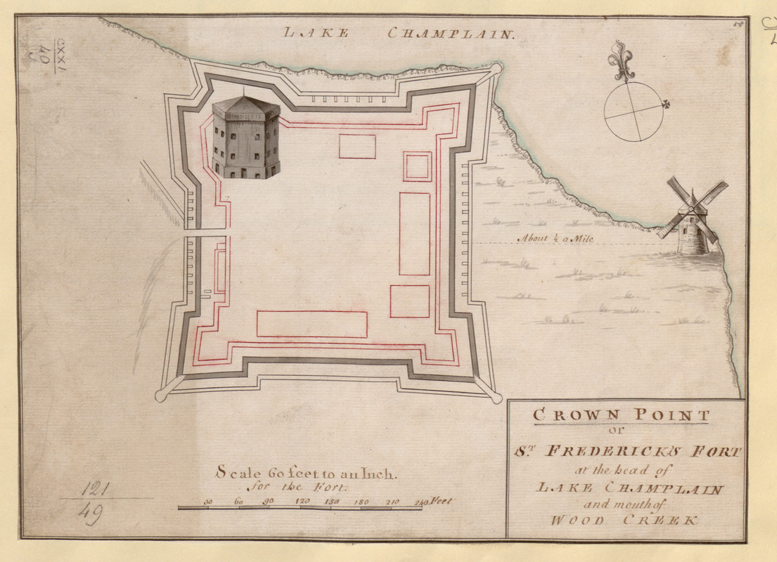
CROWN POINT or ST. FREDERICK'S FORT at the head of LAKE CHAMPLAIN and the Mouth of WOOD CREEK
This map is also available in American Revolutionary Geographies Online (ARGO), a collections portal especially built for material relating to the American Revolutionary War Era. Visit ARGO to learn more about this item and explore the historical geography of North America in the late eighteenth century.
Item Information
- Title:
- CROWN POINT or ST. FREDERICK'S FORT at the head of LAKE CHAMPLAIN and the Mouth of WOOD CREEK
- Former owner:
- George, III, King of Great Britain, 1738-1820
- Donor:
- George, IV, King of Great Britain, 1762-1830
- Date:
-
1759
- Format:
-
Maps/Atlases
Manuscripts
- Location:
- British Library
- Collection (local):
-
British Library Collection
- Subjects:
-
Fortification--New York (State)--Crown Point--Maps, Manuscript--Early works to 1800
Military art and science--New York (State)--Crown Point--Maps, Manuscript--Early works to 1800
Fort Saint Frederic (Crown Point, N.Y.)--Maps, Manuscript--Early works to 1800
United States--History--French and Indian War, 1754-1763--Maps, Manuscript--Early works to 1800
- Places:
-
Essex (county)Crown Point (cape)
- Extent:
- 1 map : manuscript pen and ink with watercolour ; 22 x 30 cm
- Terms of Use:
-
No known copyright restrictions.
This work is licensed for use under a Creative Commons Attribution Non-Commercial Share Alike License (CC BY-NC-SA).

- Scale:
-
Scale approximately 1:720
- Language:
-
English
- Catalog Record:
-
http://explore.bl.uk/BLVU1:LSCOP-ALL:BLL01016739323
- Notes:
-
Date attributed due to the map's similarity with Maps K.Top.121.48. where "1759" has been added in ink after the title.
With a "Scale of 60 feet to an Inch for the Fort" across the bottom of the map.
Title appears in a simple surround at lower right.
Shows the windmill and citadel pictorially.
With a simple compass rose in Lake Champlain orienting north to the top of the map.
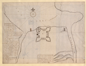
Compare with Maps K.Top.121.50. - two almost identical copies of the same map in the same hand.
Titled "A drawn Plan of Crown Point or St. Frederick's Fort" in the Catalogue of Maps, Prints, Drawings, etc., forming the geographical and topographical collection attached to the Library of his late Majesty King George the third, etc., London, 1829.
Titled 'A plan of "Crown Point, or St. Frederick's Fort, at the head of Lake Champlain and the mouth of Wood Creek, 1759;" drawn on a scale of 60 feet to an inch; 1f. x 8 1/2 in. (Three copies)' in the Catalogue of the manuscript maps, charts, and plans, and of the topographical drawings in the British Museum.