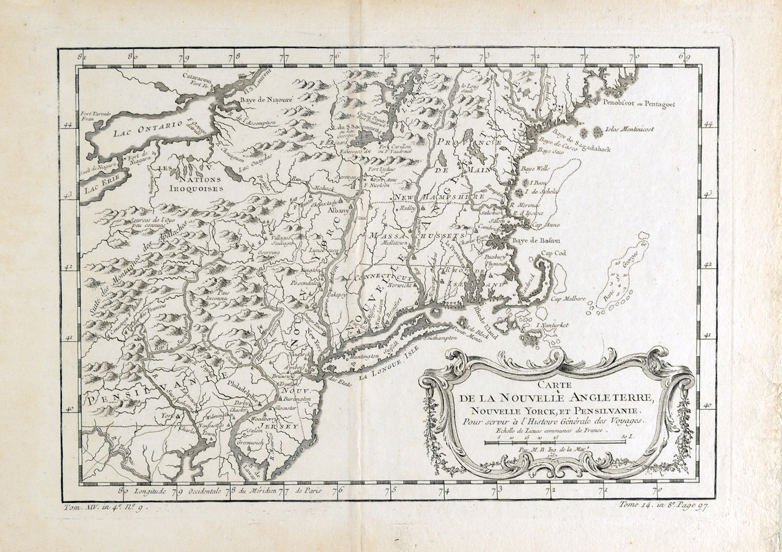
Carte de la Nouvelle Angleterre, Nouvelle Yorck, et Pensilvanie : pour servir à l'Histoire générale des voyages
This map is also available in American Revolutionary Geographies Online (ARGO), a collections portal especially built for material relating to the American Revolutionary War Era. Visit ARGO to learn more about this item and explore the historical geography of North America in the late eighteenth century.
Item Information
- Title:
- Carte de la Nouvelle Angleterre, Nouvelle Yorck, et Pensilvanie : pour servir à l'Histoire générale des voyages
- Creator:
- Bellin, Jacques Nicolas, 1703-1772
- Bookseller:
- Hôtel de Thou
- Name on Item:
-
par M. B., ing. de la mare.
- Date:
-
1757
- Format:
-
Maps/Atlases
- Location:
- Boston Athenaeum
- Collection (local):
-
Cartographic Collection
- Subjects:
-
New England--Maps--Early works to 1800
Middle Atlantic States--Maps--Early works to 1800
- Places:
-
New England (area)
Middle Atlantic (area)
- Extent:
- 1 map ; 19 x 28 cm.
- Terms of Use:
-
No known copyright restrictions.
This work is licensed for use under a Creative Commons Attribution Non-Commercial Share Alike License (CC BY-NC-SA).

- Publisher:
-
Paris :
[Hôtel de Thou]
- Scale:
-
Scale ca. 1:307,000
- Language:
-
French
- Catalog Record:
-
http://catalog.bostonathenaeum.org/vwebv/holdingsInfo?bibId=442364
- Notes:
-
Covers the area from Penobscot Bay to Chesapeake Bay and west to Lake Erie.
Shows provices, towns, forts, rivers, Indian tribal territory, and relief.
Relief shown pictorially.
Prime meridian: Paris.
"Tom. XIV. in 4⁰, no. 9. Tome 14. in 8⁰, page 97." in lower margin.
Detached from: Jean François de La Harpe's Abrégé de l'histoire générale des voyages. Paris : Hôtel de Thou, 1780-1801.
- LCCN:
-
74692223


