Toggle navigation
LMEC Home
Exhibitions
Georeferencing
Tools for Teachers
Collections
My Favorites
Sign Up / Log In
Search
Search the map portal
Map Collection
Map Collection
Map Sets
Search
Search
Search for
Search In
All Fields
Creator
Title
Subject
Place
Search All Digital Collections
Advanced Search
8192 Results
My Search
Start Over
More Like
commonwealth:9s161c45m
Remove constraint More Like: commonwealth:9s161c45m
Filter your Search
Place
North and Central America
4,930
United States
3,625
Suffolk (county)
1,026
Boston
999
Europe
963
Canada
428
France
269
Massachusetts
249
more
Place
»
Topic
Boston (Mass.)--Maps
574
United States--Maps
270
Real property--Massachusetts--Boston--Maps
174
Massachusetts--Maps
160
Landowners--Massachusetts--Boston--Maps
132
North America--Maps--Early works to 1800
105
New England--Maps
99
Europe--Maps
78
more
Topic
»
Date
Date range begin
–
Date range end
Current results range from
1482
to
2023
View distribution
Creator
United States. Hydrographic Office
357
O.H. Bailey & Co
148
Des Barres, Joseph F. W. (Joseph Frederick Wallet), 1722-1824
123
United States. Post Office Dept
120
Ptolemy, 2nd cent
100
Walling, Henry Francis, 1825-1888
94
Jefferys, Thomas, -1771
86
Geological Survey (U.S.)
82
more
Creator
»
Format
Maps/Atlases
8,133
Manuscripts
216
Prints
51
Books
36
Objects/Artifacts
10
Drawings/Illustrations
8
Posters
4
Georeferenced
Yes
869
No
7,323
Collection
Norman B. Leventhal Map Center Collection
8,162
Boston and New England Maps
2,184
Urban Maps
1,926
Maritime Charts and Atlases
750
American Revolutionary War-Era Maps
644
Boston Redevelopment Authority Collection
86
Richard H. Brown Revolutionary War Map Collection at Mount Vernon
11
British Library Collection
4
more
Collection
»
Available to use
No known restrictions
8,024
Creative Commons license
71
Search Constraints
Sort by relevance
relevance
title
date (asc)
date (desc)
Number of results to display per page
100 per page
10
per page
20
per page
50
per page
100
per page
View results as:
grid view
map view
Search Results
1.
A new and general map of the Southern dominions belonging to the United States of America, viz North Carolina, South Carolina,...
2.
Particular draughts and plans of some of the principal towns and harbours belonging to the English, French, and Spaniards, in...
3.
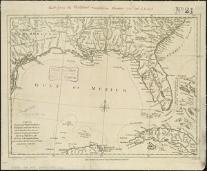
[Map of Florida, Carolina, and the Gulf Coast]
4.
Charles-town, capitale de la Caroline
5.
A chart of South Carolina and Georgia
6.
A chart of South Carolina and Georgia
7.
A chart of South Carolina and Georgia
8.
A new mapp of Carolina
9.
Plans des isles, rades, et ports de plusieurs lieux de l'Amérique : tirés de la Carte angloise de Mr. Popple publiée en 1733...
10.
Carte de la Virginie, du Maryland et de l'etat de Delaware
11.
Carte des deux Carolines et de la Géorgie
12.
Les costes aux environs de la Riviere de Misisipi : decouvertes par Mr. de la Salle en 1683 et reconnues par Mr. le Chevallier...
13.
Florida called by ye French Louisiana &c
14.
Florida from the latest authorities
15.
La Floride, suivant les nouvelles observations de Messrs. de l'Academie des Sciences, etc : augmentées de Nouveau
16.
Georgia, from the latest authorities
17.
A map of East and West Florida, Georgia, and Louisiana, with the islands of Cuba, Bahama, and the countries surrounding the...
18.
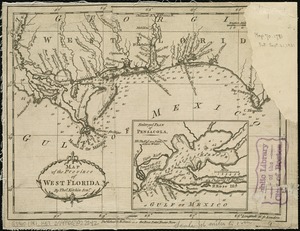
Map of the province of West Florida
19.
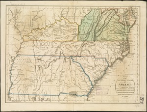
Map of the southern states of America, comprehending Maryland, Virginia, Kentucky, Territory s'th of the Ohio, North Carolina,...
20.
Boston, its environs and harbour, with the rebel works raised against that town in 1775 : from the observations of Lieut. Page...
21.
Boston with its environs
22.
Bowles's map of the seat of war in New England, comprehending the provinces of Massachusets Bay, and New Hampshire : with the...
23.
Carte des Etats-Unis de l'Amerique suivant le Traité de Paix de 1783
24.
Carte du théatre de la guerre entre les Anglais et les Américains
25.
Map for the interior travels through America, delineating the march of the army
26.
A new and accurate map of the present seat of war in North America
27.
Partie de l'Amerique Septentrionale, qui comprend le Canada, la Louisiane, le Labrador, le Groenland, la Nouvelle Angleterre,...
28.
Plan der landung der Gebrüdere Howe, bey dem ausfluss des Elk Strom ...Lords Cornwallis
29.
Plan of the town of Boston, with the attack on Bunkers-Hill, in the peninsula of Charlestown, the 17th of June, 1775
30.
The provinces of New York and New Jersey : with part of Pensilvania, and the Province of Quebec
31.
Theatre de la guerre en Amerique
32.
Théatre de la guerre en Amerique, avec les Isles Antilles : projetté et assujettie aux observations
33.
Théatre de la guerre en Amerique, avec les Isles Antilles : projetté et assujettie aux observations
34.
The theatre of war in North America, with the roads, and tables, of the superficial contents, distances, &ca
35.
PLAN of the TOWN and HARBOUR of S.T AUGUSTIN
36.
Plan of the town of St. Augustine, the capital of East Florida ; The bay of Espiritu Santo, on the western coast of East Florida
37.
Port de St. Augustin -- Port de la Providence -- La Havane dans l'isle de Cuba -- Baye de Sn. Iago dans l'isle de Cuba -- Port...
38.
ICHNOGRAPHY OF CHARLESTON, South Carolina
39.
The ICHNOGRAPHY of CHARLES-TOWN, at High Water
40.
Plan of the city of Charleston, South Carolina
41.
Sketch of the harbour of Charles Town
42.
A map of Virginia, North and South Carolina, Georgia, Maryland : with part of New Jersey &c
43.
Carte de l'Amérique Septle. pour servir à l'intelligence de la guerre entre les Anglois et les insurgents
44.
Carte des Etats-Unis d'Amérique, et du cours du Mississippi : rédigée d'après différentes cartes et relations Anglaises et...
45.
Carte des Etats-Unis de l'Amerique suivant le Traité de Paix de 1783
46.
Carte générale des colonies Angloises : dans l'Amérique Septentrionale
47.
Carte generale des colonies angloises dans l'Amerique Septentrionale pour l'intelligence de la guerre presente : d'apres des...
48.
Carte generale des colonies angloises dans l'Amerique Septentrionale pour l'intelligence de la guerre presente : d'apres des...
49.
The Country twenty five miles round New York
50.
La Dominique située entre La Martinique et La Guadeloupe : conquise par M. le Mis. de Bouillé Marechal des camps et armées du...
51.
Karte von Neu England, Neu Yorck und Pensilvanien
52.
Map for the interior travels through America : delineating the march of the army
53.
A MAP of the BRITISH COLONIES in North America : WITH THE Roads, Distances, Limits, and Extent of the SETTLEMENTS, Humbly...
54.
A new and accurate map of the present seat of war in North America : from a late survey
55.
A new and correct map of North America : in which the places of the principal engagements during the present war are accurately...
56.
A new and correct map of North America : in which the places of the principal engagements during the present war are accurately...
57.
A plan of the attack made Nov.ber 27t. 1781 : by a detachment commanded by Brigadier-General Ross, from the Garrison of...
58.
A plan of the operations of the King's army under the command of General Sr. William Howe, K.B. in New York and east New...
59.
A plan of the surprise of Stoney Point, by a detachment of the American army commanded by Brigr. Genl. Wayne, on the 15th July...
60.
The seat of war, in New England, by an American volunteer : with the marches of the several corps sent by the colonies, towards...
61.
A sketch of Charleston Harbour : shewing the disposition of the British fleet under the command of Vice Adml. Mariot Arbuthnot...
62.
Suite du theatre de la guerre dans l'Amérique Septentrionale y compris le Golfe du Méxique
63.
Théatre de la guerre en Amerique, avec les Isles Antilles : projetté et assujettie aux observations
64.
The 100th anniversary map of Abraham Lincoln's visit to Massachusetts, September 11-23, 1848
65.
1630 shoreline
66.
1879. Progress map of the U.S. Geographical Surveys west of the 100th Meridian : prepared under the direction of 1st Lieut....
67.
1903 Map of Salem and surrounding places
68.
19th annual convention of the National Association of Real Estate Boards : at Tulsa, June 7 to June 11 in 1926
69.
2005 significant U.S. hurricane strikes
70.
The 2100 project : an atlas for the Green New Deal
71.
227 Harzgerode
72.
305 Glatz
73.
38,000,000 escaped -- 10,000,000 died
74.
4 Kinten
75.
660 Wakulah St., Roxbury
76.
[A chart of Boston Bay and vicinity]
77.
[A chart of New York Island & North River : East River, passage through Hell Gate, Flushing Bay, Hampstead Bay, Oyster,...
78.
The A.A.A. key road map of continental Europe
79.
Aaron Bohrod's America, its history
80.
ABC pathfinder railway guide map : eastern division
81.
Abolition of Slavery, 1863
82.
Aboriginal map of North America, denoting the boundaries and the locations of various Indian tribes
83.
Acapulco, México
84.
Accurata delineatio Castrorum Suecicorum, ut et Haffniae, Regni Daniae Metropolis
85.
Accurata delineatio oppugnatae a faederatis, Caesareis, Polonicis, Danicis, et Brandeburgicis copijs sub-ductu Seren: Electoris...
86.
Accurata delineatio regionis circa Nieburgum Fioniæ cum prælio ibi commisso inter Danorum et fæderatorum exercitum ab una et...
87.
Accurata Scaniae, Blekingiae et Hallandiae descriptio
88.
An accurate map of Cuba, and the adjacent islands
89.
An accurate map of Dorset Shire divided into hundreds
90.
An accurate map of Dorset Shire, divided into its hundreds
91.
An accurate map of England and Wales with the principal roads from the best authorities
92.
An accurate map of England and Wales with the principal roads from the best authorities
93.
An accurate map of Europe from the best authorities
94.
An accurate map of Hindostan or India, from the best authorities
95.
An accurate map of His Majesty's province of New-Hampshire in New England : taken from actual surveys of all the inhabited...
96.
An Accurate map of New Hampshire in New England, from a late survey
97.
An Accurate map of New York in North America, from a late survey
98.
An accurate map of North America : describing and distinguishing the British and Spanish dominions on this great continent :...
99.
An accurate map of North America : describing and distinguishing the British and Spanish dominions of this great continent;...
100.
An accurate map of North America : describing and distinguishing the British, Spanish and French dominions on this great...
‹ Prev
Next ›
1
2
3
4
5
…
81
82


![[Map of Florida, Carolina, and the Gulf Coast]](https://bpldcassets.blob.core.windows.net/derivatives/images/commonwealth:z603vr379/image_thumbnail_300.jpg)


![[A chart of Boston Bay and vicinity]](https://bpldcassets.blob.core.windows.net/derivatives/images/commonwealth:cj82m2976/image_thumbnail_300.jpg)


