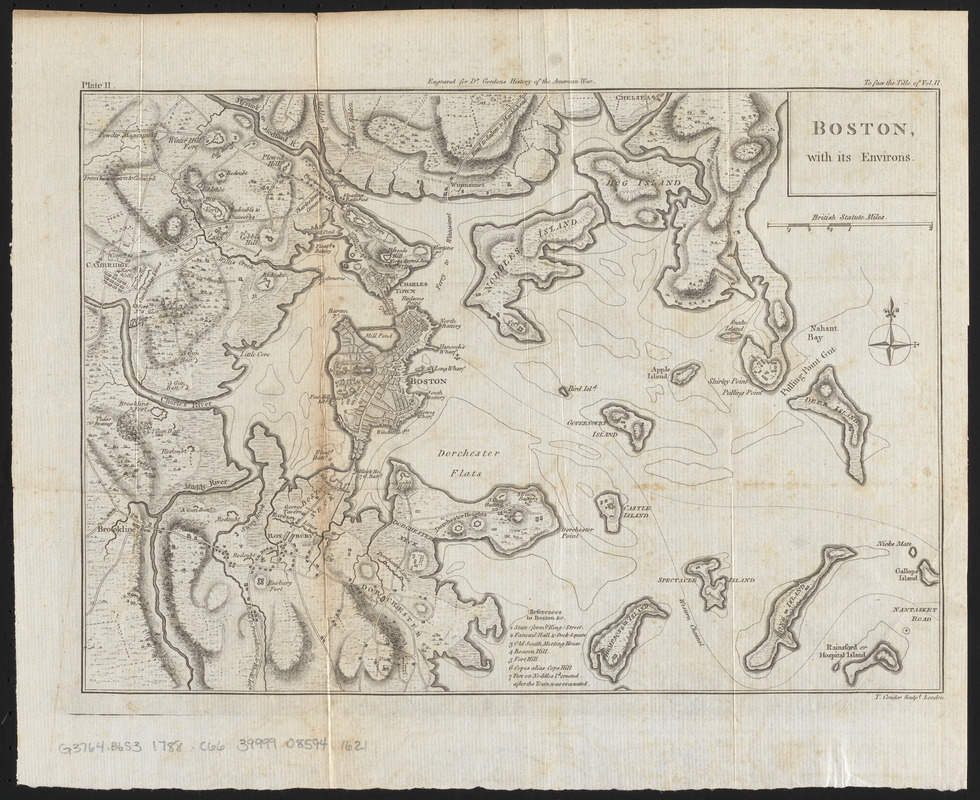
Boston with its environs
This map is also available in American Revolutionary Geographies Online (ARGO), a collections portal especially built for material relating to the American Revolutionary War Era. Visit ARGO to learn more about this item and explore the historical geography of North America in the late eighteenth century.
Item Information
- Title:
- Boston with its environs
- Creator:
- Conder, Thomas, 1746 or 1747-1831
- Engraver:
- Conder, Thomas, 1746 or 1747-1831
- Name on Item:
-
T. Conder, sculpt.
- Date:
-
[1788]
- Format:
-
Maps/Atlases
- Location:
-
Boston Public Library
Norman B. Leventhal Map & Education Center - Collection (local):
-
Norman B. Leventhal Map & Education Center Collection
- Subjects:
-
Boston (Mass.)--History--Revolution, 1775-1783--Maps--Early works to 1800
United States--History--Revolution, 1775-1783--Maps--Early works to 1800
Boston Harbor (Mass.)--Maps--Early works to 1800
- Places:
-
MassachusettsBoston Harbor
MassachusettsSuffolk (county)Boston
- Extent:
- 1 map ; 23 x 33 cm
- Terms of Use:
-
No known copyright restrictions.
No known restrictions on use.
- Publisher:
-
[London] :
[Printed for the author]
- Scale:
-
Scale approximately 1:52,000
- Language:
-
English
- Notes:
-
Shows positions of troops, redoubts, batteries, and forts.
Relief shown by hachures.
In upper center margin: Engraved for Dr. Gordons History of the American war.
Appears in: William Gordon's The history of the rise, progress, and establishment, of the independence of the United States of America, 1788.
Includes "references" to points of interest.
In upper left margin: Plate II.
In upper right margin: To face the title of vol. II.
- Notes (date):
-
This date is inferred.
- Identifier:
-
06_01_016026
- Call #:
-
G3764.B6S3 1788 .C66
- Barcode:
-
39999085941621


