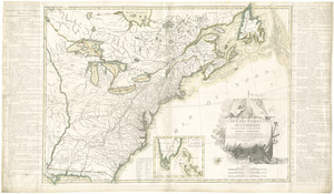
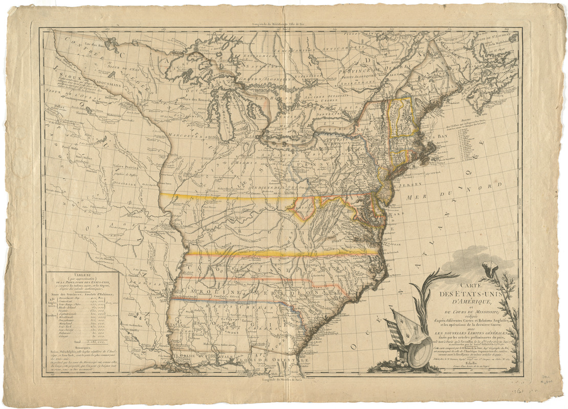
Carte des Etats-Unis d'Amérique, et du cours du Mississippi : rédigée d'après différentes cartes et relations Anglaises et les opérations de la derniere guerre; avec les nouvelles limites générales fixées par les articles préliminaires de paix, signés tant à Paris qu'à Versailles le 30 9bre, 1782 et le 20 janr. 1783 et confirmées par le traité définitif du 3 7bre 1783
This map is also available in American Revolutionary Geographies Online (ARGO), a collections portal especially built for material relating to the American Revolutionary War Era. Visit ARGO to learn more about this item and explore the historical geography of North America in the late eighteenth century.
Item Information
- Title:
- Carte des Etats-Unis d'Amérique, et du cours du Mississippi : rédigée d'après différentes cartes et relations Anglaises et les opérations de la derniere guerre; avec les nouvelles limites générales fixées par les articles préliminaires de paix, signés tant à Paris qu'à Versailles le 30 9bre, 1782 et le 20 janr. 1783 et confirmées par le traité définitif du 3 7bre 1783
- Creator:
- Brion de la Tour, Louis
- Contributor:
- Desnos, Louis-Charles, 1725-1805
- Name on Item:
-
cette carte composée par le Sr. Brion de la Tour ... est accompagnée de celle de l'Amerique Septentrionale entière, servant aussi à l'intelligence des mêmes articles de paix.
- Date:
-
[1783–1787]
- Format:
-
Maps/Atlases
- Location:
- George Washington's Mount Vernon
- Collection (local):
-
Richard H. Brown Revolutionary War Map Collection at Mount Vernon
- Subjects:
-
United States--History--Revolution, 1775-1783--Maps--Early works to 1800
- Places:
-
- Extent:
- 1 map : hand col. ; 51 x 69 cm.
- Terms of Use:
-
No known copyright restrictions.
This work is licensed for use under a Creative Commons Attribution Non-Commercial Share Alike License (CC BY-NC-SA).

- Publisher:
-
Paris :
Chez le Sr. Desnos
- Scale:
-
Scale [ca. 1:4,400,000]
- Language:
-
French
- Catalog Record:
-
MVLA record
- Notes:
-
Relief shown pictorially.
Prime meridian: Paris and Isle de Fer.
Includes tableau (par approximation) de la population des Etats-Unis.
Decorative title cartouche.
Similar to LC Maps of North America, 1750-1789, 746; with a different publisher.
- Notes (date):
-
This date is inferred.
- Identifier:
-
06_01_008245