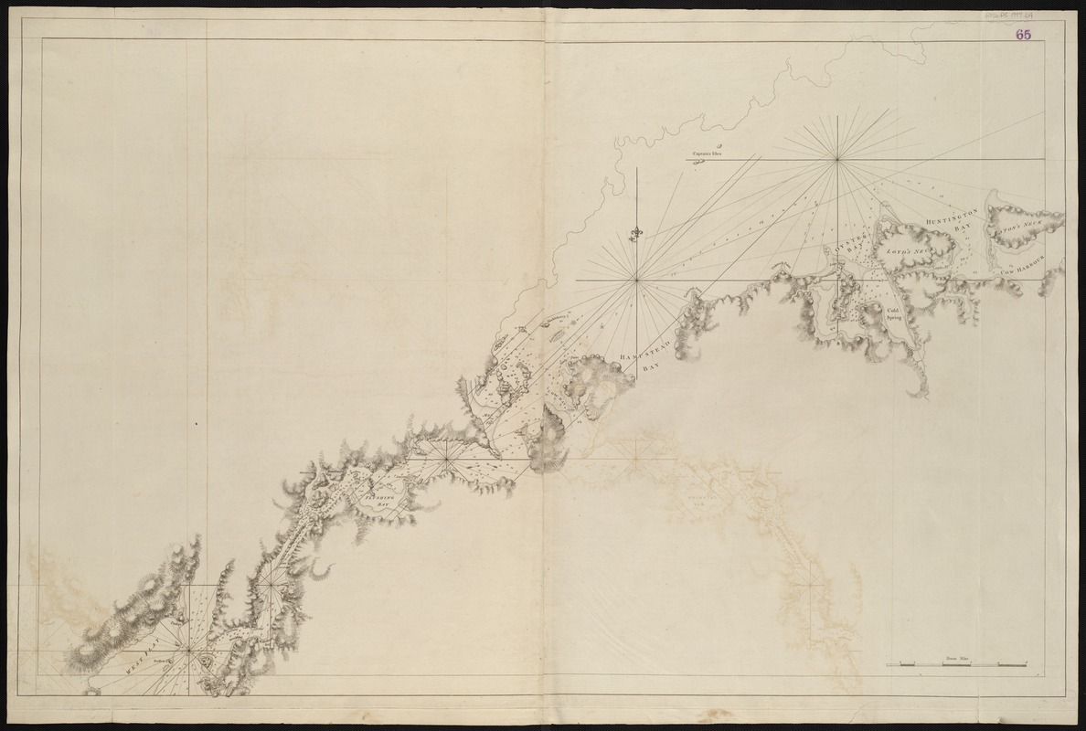
[A chart of New York Island & North River : East River, passage through Hell Gate, Flushing Bay, Hampstead Bay, Oyster, Huntington Bay, Cow Harbour, East Chester Inlet, Rochell, Rye, Patrick Islands, &c.]
This map is also available in American Revolutionary Geographies Online (ARGO), a collections portal especially built for material relating to the American Revolutionary War Era. Visit ARGO to learn more about this item and explore the historical geography of North America in the late eighteenth century.
Item Information
- Title:
- [A chart of New York Island & North River : East River, passage through Hell Gate, Flushing Bay, Hampstead Bay, Oyster, Huntington Bay, Cow Harbour, East Chester Inlet, Rochell, Rye, Patrick Islands, &c.]
- Creator:
- Des Barres, Joseph F. W. (Joseph Frederick Wallet), 1722-1824
- Date:
-
[1770–1779]
- Format:
-
Maps/Atlases
- Location:
-
Boston Public Library
Norman B. Leventhal Map & Education Center - Collection (local):
-
Norman B. Leventhal Map & Education Center Collection
- Subjects:
-
Nautical charts--New York (State)--Long Island--Early works to 1800
Coasts--New York (State)--Long Island--Maps--Early works to 1800
Long Island (N.Y.)--Maps--Early works to 1800
- Places:
-
New YorkLong Island (island)
- Extent:
- 1 chart ; 73 x 115 cm.
- Terms of Use:
-
No known copyright restrictions.
No known restrictions on use.
- Publisher:
-
London :
J.F.W. Des Barres
- Scale:
-
Scale [ca. 1:52,000]
- Language:
-
English
- Notes:
-
Title from published bibliography.
Relief shown by hachures. Depths shown by soundings.
Shows Long Island north shore from Eaton's Neck west to Cow Bay.
Appears in the author's Atlantic Neptune. London : [J.F.W. Des Barres], 1777-[1781].
- Notes (date):
-
This date is inferred.
- Identifier:
-
06_01_004992
- Call #:
-
G1106.P5 D47 1777
- Barcode:
-
30000003813665
- LCCN:
-
77693971
![[Coast of Rhode Island and Long Island from Narragansett Bay to Peconic Bay]](https://bpldcassets.blob.core.windows.net/derivatives/images/commonwealth:7h149z14m/image_thumbnail_300.jpg)


