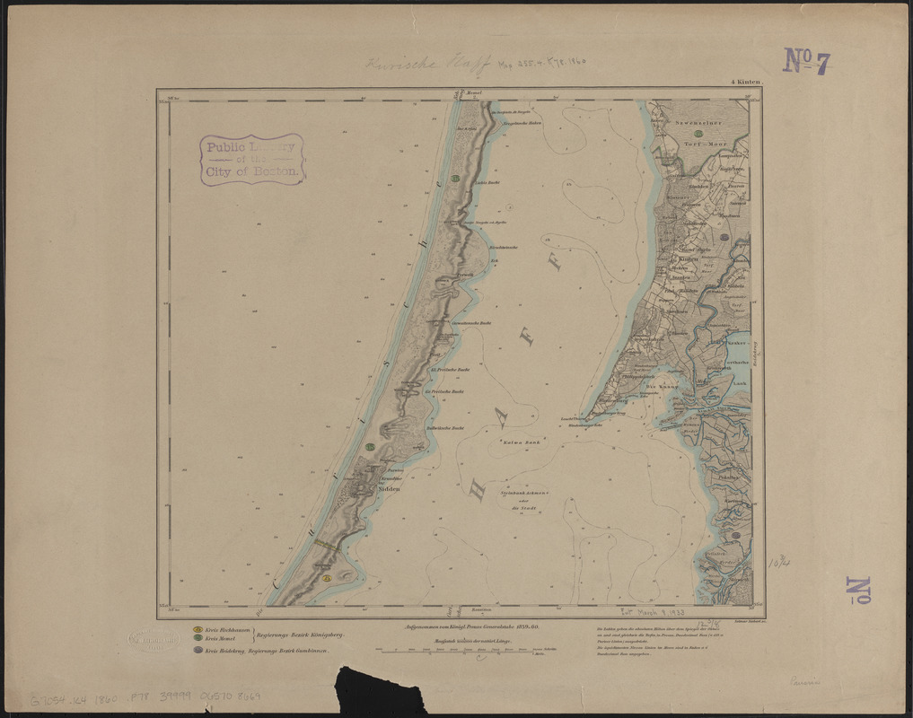
4 Kinten
Item Information
- Title:
- 4 Kinten
- Title (alt.):
-
Kinten
- Cartographer:
- Prussia (Kingdom). Armee. Grosser Generalstab
- Engraver:
- Siebert, Selmar
- Name on Item:
-
aufgenommen vom Königl. Preuss: Generalstabe ; Selmar Siebert sc.
- Date:
-
1860
- Format:
-
Maps/Atlases
- Location:
-
Boston Public Library
Norman B. Leventhal Map & Education Center - Collection (local):
-
Norman B. Leventhal Map & Education Center Collection
- Subjects:
-
Kintai (Lithuania)--Maps
- Places:
-
Lithuania
Kintai
- Extent:
- 1 map : color ; 28 x 32 cm
- Terms of Use:
-
No known copyright restrictions.
No known restrictions on use.
- Publisher:
-
[Berlin] :
Konigl. Preuss. Generalstabe
- Scale:
-
Scale 1:100,000
- Language:
-
German
- Notes:
-
Relief shown by hachures and spot heights. Depths shown by isolines and soundings.
Topographische Karte vom Preußischen Staat no. 4.
- Identifier:
-
06_01_014929
- Call #:
-
G7054.K4 1860 .P78
- Barcode:
-
39999065708669


