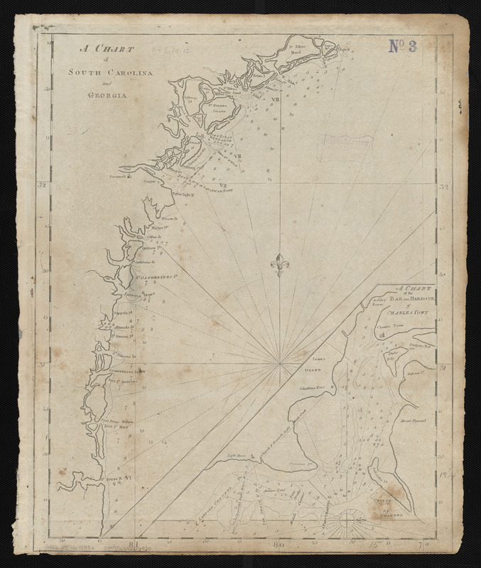
A chart of South Carolina and Georgia
Item Information
- Title:
- A chart of South Carolina and Georgia
- Creator:
- Norman, John, 1748?-1817
- Cartographer:
- Norman, John, 1748?-1817
- Publisher:
- Norman, William, -1807
- Date:
-
[1798]
- Format:
-
Maps/Atlases
- Location:
-
Boston Public Library
Norman B. Leventhal Map & Education Center - Collection (local):
-
Norman B. Leventhal Map & Education Center Collection
- Subjects:
-
Coasts--Georgia--Maps--Early works to 1800
Coasts--South Carolina--Maps--Early works to 1800
Georgia--Maps--Early works to 1800
South Carolina--Maps--Early works to 1800
Charleston (S.C.)--Maps--Early works to 1800
- Places:
-
Georgia
South CarolinaCharleston (county)Charleston
- Extent:
- 1 map ; 50 x 38 cm
- Terms of Use:
-
No known copyright restrictions.
No known restrictions on use.
- Publisher:
-
[Boston] :
[William Norman]
- Scale:
-
Scale approximately 1:625,000
- Language:
-
English
- Notes:
-
Depths shown by soundings.
Inset: A chart of the bar and harbour of Charles Town.
In Norman's The American pilot. Boston : William Norman, 1798.
- Notes (date):
-
This date is inferred.
- Identifier:
-
06_01_004838
- Call #:
-
G1106.P5 N6 1798x
- Barcode:
-
30000005069230


