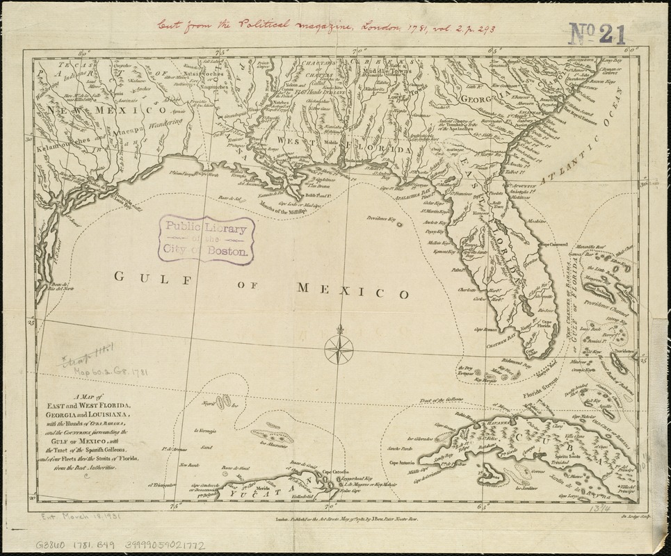
A map of East and West Florida, Georgia, and Louisiana, with the islands of Cuba, Bahama, and the countries surrounding the Gulf of Mexico, with the tract of the Spanish galleons, and of our fleets thro' the Straits of Florida, from the best authorities
This map is also available in American Revolutionary Geographies Online (ARGO), a collections portal especially built for material relating to the American Revolutionary War Era. Visit ARGO to learn more about this item and explore the historical geography of North America in the late eighteenth century.
Item Information
- Title:
- A map of East and West Florida, Georgia, and Louisiana, with the islands of Cuba, Bahama, and the countries surrounding the Gulf of Mexico, with the tract of the Spanish galleons, and of our fleets thro' the Straits of Florida, from the best authorities
- Creator:
- Bew, John, d. 1793
- Name on Item:
-
Jn. Lodge, sculp.
- Date:
-
1781
- Format:
-
Maps/Atlases
- Location:
-
Boston Public Library
Norman B. Leventhal Map & Education Center - Collection (local):
-
Norman B. Leventhal Map & Education Center Collection
- Subjects:
-
Southern States--Maps--Early works to 1800
- Places:
-
Southern United States (area)
- Extent:
- 1 map : col. ; 27 x 36 cm.
- Terms of Use:
-
No known copyright restrictions.
No known restrictions on use.
- Publisher:
-
London :
J. Bew
- Scale:
-
Scale ca. 1:5,300,000.
- Language:
-
English
- Notes:
-
Relief shown pictorially.
Hand colored.
Appears in the Political magazine, May, 1781, v. 2, p. 293.
- Identifier:
-
06_01_006256
- Call #:
-
G3860 1781 .B49
- Barcode:
-
39999059021772
- LCCN:
-
79691140


