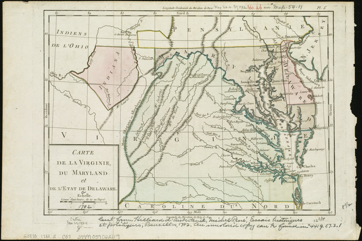
Carte de la Virginie, du Maryland et de l'etat de Delaware
This map is also available in American Revolutionary Geographies Online (ARGO), a collections portal especially built for material relating to the American Revolutionary War Era. Visit ARGO to learn more about this item and explore the historical geography of North America in the late eighteenth century.
Item Information
- Title:
- Carte de la Virginie, du Maryland et de l'etat de Delaware
- Date:
-
[1782]
- Format:
-
Maps/Atlases
- Location:
-
Boston Public Library
Norman B. Leventhal Map & Education Center - Collection (local):
-
Norman B. Leventhal Map & Education Center Collection
- Subjects:
-
Virginia--Maps--Early works to 1800
Maryland--Maps--Early works to 1800
Delaware--Maps--Early works to 1800
Southern States--Maps--Early works to 1800
- Places:
-
Virginia
Maryland
Southern United States (area)
Delaware
- Extent:
- 1 map : hand col. ; 22 x 32 cm.
- Terms of Use:
-
No known copyright restrictions.
No known restrictions on use.
- Publisher:
-
Bruxelles :
Hilliard d'Auberteuil
- Scale:
-
Scale [ca. 1:2,150,000].
- Language:
-
French
- Notes:
-
Relief shown pictorially.
Prime meridians: Paris and Ferro.
In upper right margin: Pl. 5.
Appears in Hilliard d'Auberteuil's Essais historiques et politiques sur les Anglo-Americains.
- Notes (date):
-
This date is inferred.
- Identifier:
-
06_01_006285
- Call #:
-
G3870 1782.2 .C37
- Barcode:
-
39999059022119