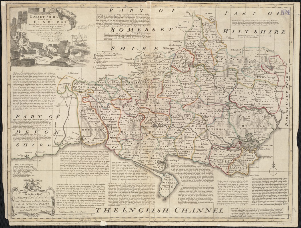
An accurate map of Dorset Shire, divided into its hundreds
Item Information
- Title:
- An accurate map of Dorset Shire, divided into its hundreds
- Creator:
- Bowen, Emanuel, d. 1767
- Publisher:
- Bowles, John, 1701-1779
- Publisher:
- Bowles, Carington, 1724-1793
- Publisher:
- Sayer, Robert, 1725-1794
- Name on Item:
-
Drawn from the best authorities, assisted by the most approved maps & charts, with various improvements. Illustrated with historical extracts relative to its natural produce, manufactures, trade, present state of its principal towns & sea ports &c. by Eman: Bowen ...
- Date:
-
[1764]
- Format:
-
Maps/Atlases
- Location:
-
Boston Public Library
Norman B. Leventhal Map & Education Center - Collection (local):
-
Norman B. Leventhal Map & Education Center Collection
- Subjects:
-
Dorset (England)--Maps--Early works to 1800
- Places:
-
EnglandDorset (county)
- Extent:
- 1 map : outline col. ; 52 x 69 cm.
- Terms of Use:
-
No known copyright restrictions.
No known restrictions on use.
- Publisher:
-
[London] :
Printed for John Bowles ..., Carington Bowles ..., & Robert Sayer ...
- Scale:
-
Scale [1:180,000].
- Language:
-
English
- Notes:
-
Relief shown pictorially, and with hachures.
Numbered "12."
London meridian, with graticule.
Includes notes about the county.
Shows boundaries, roads, parks and settlements.
Dedicated to the Lord Lieutenant.
Appears in the author's Large English Atlas. London : Printed and sold by Robert Sayer, [1777?].
Differs from previous states by the change in imprint.
County of Dorset, divided into hundreds.
- Notes (date):
-
This date is inferred.
- Identifier:
-
06_01_006970
- Call #:
-
G5753.D6 1764 .B69
- Barcode:
-
39999059028918


