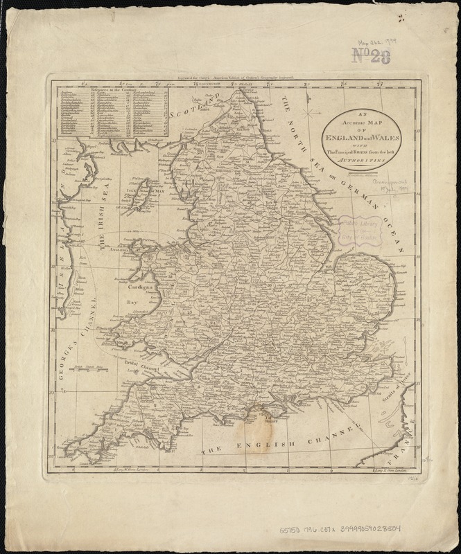
An accurate map of England and Wales with the principal roads from the best authorities
Item Information
- Title:
- An accurate map of England and Wales with the principal roads from the best authorities
- Creator:
- Carey, Mathew, 1760-1839
- Date:
-
[1796–1800]
- Format:
-
Maps/Atlases
- Location:
-
Boston Public Library
Norman B. Leventhal Map & Education Center - Collection (local):
-
Norman B. Leventhal Map & Education Center Collection
- Subjects:
-
England--Maps--Early works to 1800
Wales--Maps--Early works to 1800
- Places:
-
Wales
England
- Extent:
- 1 map ; 33 x 31 cm.
- Terms of Use:
-
No known copyright restrictions.
No known restrictions on use.
- Publisher:
-
Philadelphia :
M. Carey
- Scale:
-
Scale not given.
- Language:
-
English
- Notes:
-
Relief shown pictorially.
"Engraved for Carey's American edition of Guthrie's Geography Improved."
Appears in Carey's General Atlas. Philadelphia, 1796 or 1800.
- Notes (date):
-
This date is inferred.
- Identifier:
-
06_01_006835
- Call #:
-
G5750 1796 .C37x
- Barcode:
-
39999059028504