Toggle navigation
LMEC Home
Exhibitions
Georeferencing
Tools for Teachers
Collections
My Favorites
Sign Up / Log In
Search
Search the map portal
Map Collection
Map Collection
Map Sets
Search
Search
Search for
Search In
All Fields
Creator
Title
Subject
Place
Search All Digital Collections
Advanced Search
483 Results
My Search
Start Over
More Like
commonwealth:z603vs42c
Remove constraint More Like: commonwealth:z603vs42c
Filter your Search
Place
North and Central America
281
United States
200
North America
180
Canada
48
New York
36
Suffolk (county)
35
Boston
33
New England
17
more
Place
»
Topic
North America--Maps--Early works to 1800
180
United States--History--Revolution, 1775-1783--Maps--Early works to 1800
36
United States--Maps--Early works to 1800
24
Boston (Mass.)--History--Revolution, 1775-1783--Maps--Early works to 1800
18
Canada--Maps--Early works to 1800
16
Great Britain--Colonies--America--Maps--Early works to 1800
15
New England--Maps--Early works to 1800
14
United States--History--French and Indian War, 1754-1763--Maps--Early works to 1800
11
more
Topic
»
Date
Date range begin
–
Date range end
Current results range from
1528
to
1850
View distribution
Creator
Jefferys, Thomas, -1771
39
Faden, William, 1749-1836
36
Sayer, Robert, 1725-1794
28
Le Rouge, Georges-Louis
25
Des Barres, Joseph F. W. (Joseph Frederick Wallet), 1722-1824
21
Mitchell, John, 1711-1768
14
Robert Sayer and John Bennett (Firm)
12
Korn, Christoph Heinrich, 1726-1783
11
more
Creator
»
Format
Maps/Atlases
440
Prints
32
Manuscripts
25
Drawings/Illustrations
9
Books
2
Georeferenced
Yes
17
No
466
Collection
American Revolutionary War-Era Maps
418
Richard H. Brown Revolutionary War Map Collection at Mount Vernon
293
Norman B. Leventhal Map Center Collection
127
New York Public Library Collection
35
Boston and New England Maps
10
Mapping Boston Collection
9
Sidney R. Knafel Map Collection at Phillips Academy
9
New-York Historical Society Collection
6
more
Collection
»
Available to use
Creative Commons license
346
No known restrictions
124
Search Constraints
Sort by relevance
relevance
title
date (asc)
date (desc)
Number of results to display per page
100 per page
10
per page
20
per page
50
per page
100
per page
View results as:
grid view
map view
Search Results
1.
A MAP of the BRITISH COLONIES in North America : WITH THE Roads, Distances, Limits, and Extent of the SETTLEMENTS, Humbly...
2.
Partie de l'Amerique Septentrionale, qui comprend le Canada, la Louisiane, le Labrador, le Groenland, la Nouvelle Angleterre,...
3.
Carte des Etats-Unis d'Amérique, et du cours du Mississippi : rédigée d'après différentes cartes et relations Anglaises et...
4.
Carte des Etats-Unis de l'Amerique suivant le Traité de Paix de 1783
5.
Carte generale des colonies angloises dans l'Amerique Septentrionale pour l'intelligence de la guerre presente : d'apres des...
6.
Karte von Neu England, Neu Yorck und Pensilvanien
7.
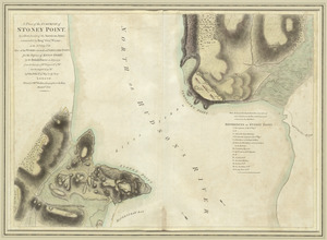
A plan of the surprise of Stoney Point, by a detachment of the American army commanded by Brigr. Genl. Wayne, on the 15th July...
8.
Suite du theatre de la guerre dans l'Amérique Septentrionale y compris le Golfe du Méxique
9.
Théatre de la guerre en Amerique, avec les Isles Antilles : projetté et assujettie aux observations
10.
L'Amerique divisée en septentrionale et méridionale, subdivisée en ses principales parties, dressée sur les relations les...
11.
Amérique septentrionale avec les routes, distances en miles, limites et etablissements françois et anglois
12.
Amerique Septentrionale divisée en ses principales parties, ou sont distingués les vns des autres les estats suivant qu'il...
13.
Amérique Septentrionale dressée sur les relations les plus modernes des voyageurs et navigateurs, ou se remarquent les Etats...
14.
L'Amerique Septentrionale, ou se remarquent les Etats Unis
15.
Bowles's new and accurate map of North America and the West Indies : exhibiting the extent and boundaries of the United States,...
16.
Carte des possessions angloises dans l'Amerique Septentrionale pour servir d'intelligence à la guerre presente traduite de...
17.
Chart of the Atlantic Ocean, with the British, French, & Spanish settlements in North America, and the West Indies : as also on...
18.
A general map of North America : in which is express'd the several new roads, forts, engagements, &c, taken from actual surveys...
19.
LʼAmérique Septentrionale et Méridionale divisée suivant ses différens pays
20.
A map of the British and French dominions in North America with the roads, distances, limits, and extent of the settlements,...
21.
A new and correct map of North America, with the West India Islands : divided according to the last Treaty of Peace, concluded...
22.
A new map of North America wherein the British Dominions in the continent of North America : and on the islands of the West...
23.
A new map of the British colonies in North America, shewing the seat of the present war, taken from the best surveys, compared...
24.
North America from the French of Mr. D'Anville, improved with the back settlements of Virginia and course of Ohio, illustrated...
25.
Rade et port de Plaisance -- Le Port d'Anapolis dans l'Acadie -- Port de Boston dans la Nouvlle. Angleterre
26.
Theodolite's pattern, shewing the provinces in North America which were in the respective possessions of England, France &...
27.
Boston, its environs and harbour, with the rebel works raised against that town in 1775 : from the observations of Lieut. Page...
28.
Boston with its environs
29.
Bowles's map of the seat of war in New England, comprehending the provinces of Massachusets Bay, and New Hampshire : with the...
30.
Carte des Etats-Unis de l'Amerique suivant le Traité de Paix de 1783
31.
Carte du théatre de la guerre entre les Anglais et les Américains
32.
Carte générale des colonies Angloises : dans l'Amérique Septentrionale
33.
Carte generale des colonies angloises dans l'Amerique Septentrionale pour l'intelligence de la guerre presente : d'apres des...
34.
The Country twenty five miles round New York
35.
La Dominique située entre La Martinique et La Guadeloupe : conquise par M. le Mis. de Bouillé Marechal des camps et armées du...
36.
A general map of the southern British colonies in America comprehending North and South Carolina, Georgia, East and West...
37.
Map for the interior travels through America : delineating the march of the army
38.
Map for the interior travels through America, delineating the march of the army
39.
A new and accurate map of the present seat of war in North America
40.
A new and accurate map of the present seat of war in North America : from a late survey
41.
A new and correct map of North America : in which the places of the principal engagements during the present war are accurately...
42.
A new and correct map of North America : in which the places of the principal engagements during the present war are accurately...
43.
Plan der landung der Gebrüdere Howe, bey dem ausfluss des Elk Strom ...Lords Cornwallis
44.
A plan of the attack made Nov.ber 27t. 1781 : by a detachment commanded by Brigadier-General Ross, from the Garrison of...
45.
A plan of the operations of the King's army under the command of General Sr. William Howe, K.B. in New York and east New...
46.
Plan of the town of Boston, with the attack on Bunkers-Hill, in the peninsula of Charlestown, the 17th of June, 1775
47.
The provinces of New York and New Jersey : with part of Pensilvania, and the Province of Quebec
48.
The seat of war, in New England, by an American volunteer : with the marches of the several corps sent by the colonies, towards...
49.
A sketch of Charleston Harbour : shewing the disposition of the British fleet under the command of Vice Adml. Mariot Arbuthnot...
50.
Theatre de la guerre en Amerique
51.
Théatre de la guerre en Amerique, avec les Isles Antilles : projetté et assujettie aux observations
52.
Théatre de la guerre en Amerique, avec les Isles Antilles : projetté et assujettie aux observations
53.
The theatre of war in North America, with the roads, and tables, of the superficial contents, distances, &ca
54.
[A map of the east coast of America from Newfoundland to the Bay of Honduras]
55.
An accurate map of North America : Describing and distinguishing the British and Spanish dominions of this great continent;...
56.
An accurate map of North America : describing and distinguishing the British and Spanish dominions on this great continent :...
57.
An accurate map of North America : describing and distinguishing the British and Spanish dominions on this great continent :...
58.
An accurate map of North America : describing and distinguishing the British and Spanish dominions of this great continent;...
59.
An accurate map of North America : describing and distinguishing the British, Spanish and French dominions on this great...
60.
An accurate map of the British Empire in Nth. America as settled by the preliminaries in 1762
61.
An accurate map of the British, French & Spanish settlements in Nth. America and the West Indies : as stipulated by the...
62.
An Accurate map of the present seat of war between Great-Britain and her colonies in North America
63.
Acurate charte von Nord-America : aus dem besten quellen
64.
America : with those known parts in that unknowne worlde both people and manner of buildings discribed and inlarged
65.
America septentrionalis
66.
America Septentrionalis : concinnata juxta observationes Dnn Academiae Regalis Scientiarum et nonnullorum aliorum, et juxta...
67.
America Septentrionalis
68.
America Septentrionalis a Domino d'Anville in Galliis edita nunc in Anglia : Coloniis in interiorem Virginiam deductis nec non...
69.
America Settentrionale : colle nuove scoperte fin alle' anno 1688 divisa nelle sue partu secondo lo stato presente
70.
America settentrionale divisa ne' suoi principali stati
71.
America sive novvs orbis respectv Evropaeorvm inferior globi terrestris pars
72.
America sive novvs orbis respectv Evropaeorvm inferior globi terrestris pars
73.
Americae pars Borealis, Florida, Baccalaos, Canada, Corterealis
74.
L'Amérique septentrionale
75.
Amérique Septentrionale
76.
Amérique Septentrionale
77.
Amérique Septentrionale : dressée sur les relations les plus modernes des voyageurs et navigateurs, et divisée suivant les...
78.
Amérique septentrionale
79.
L'Amerique septentrionale
80.
L'Amérique Septentrionale
81.
[Amerique septentrionale]
82.
Amérique septentrionale avec les routes, distances en miles, villages, et etablissements François et Anglois
83.
Amerique septentrionale divisée en ses principale parties
84.
Amerique septentrionale divisée en ses principales parties
85.
Amerique septentrionale divisée en ses principales parties : ou sont distingués les uns des autres les etats suivant quils...
86.
L'Amérique Septentrionale divisée en ses principaux états
87.
BOWLES'S NEW POCKET MAP OF THE UNITED STATES OF AMERICA : WITH THE BRITISH POSSESSIONS OF CANADA, NOVA SCOTIA, AND OF...
88.
British colonies in North America : drawn from the best authorities
89.
British dominions in America, drawn from the latest and best authorities
90.
Le Canada, ou Nouvelle France, &c : ce qui est le plus advance vers le Septentrion est tiré de diverses relations des Anglois,...
91.
Le Canada, ou Nouvelle France, la Floride, la Virginie, Pensilvanie, Caroline, Nouvelle Angleterre et Nouvelle Yorck, l'Isle de...
92.
Carte de la Louisiane et des pays voisins : dédiée à M. Rouillé, sécretaire d'État, ayant le Département de la marine
93.
Carte de la Louisiane et des pays voisins dédiée à M. Rouillé sécretaire d'état, ayant le Département de la marine
94.
Carte de la Nouuelle France, augmentée depuis la derniere, seruant a la navigation faicte en son vray Meridien
95.
Carte de la Nouuelle France et de la Louisiane nouuellement découuerte : dediée au Roy l'an 1683
96.
Carte de l'Amérique septentrionale, 1754
97.
Carte de l'Amérique septentrionale, depuis la baye d'Hudson jusqu'au Mississipi : pour servir aux essais historiques et...
98.
Carte des possessions angloises & françoises du continent de l'Amérique septentrionale = Kaart van de Engelsche en Fransche...
99.
Carte des possessions des Anglois en Amerique, par rapport à leurs differends avec la France
100.
Carte detaillée des possessions angloises dans l'Amerique Septentrionale : construite d'après les dernieres relations et les...
‹ Prev
Next ›
1
2
3
4
5


![[A map of the east coast of America from Newfoundland to the Bay of Honduras]](https://bpldcassets.blob.core.windows.net/derivatives/images/commonwealth:hx11z584h/image_thumbnail_300.jpg)


![[Amerique septentrionale]](https://bpldcassets.blob.core.windows.net/derivatives/images/commonwealth:8336h2955/image_thumbnail_300.jpg)