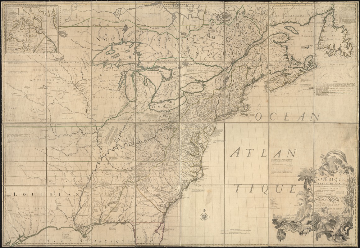
Amérique septentrionale avec les routes, distances en miles, villages, et etablissements François et Anglois
This map is also available in American Revolutionary Geographies Online (ARGO), a collections portal especially built for material relating to the American Revolutionary War Era. Visit ARGO to learn more about this item and explore the historical geography of North America in the late eighteenth century.
Item Information
- Title:
- Amérique septentrionale avec les routes, distances en miles, villages, et etablissements François et Anglois
- Creator:
- Mitchell, John, 1711-1768
- Name on Item:
-
par le docteur Mitchel ; corigée en 1776 par M. Hawkins.
- Date:
-
1777
- Format:
-
Maps/Atlases
- Location:
-
Boston Public Library
Norman B. Leventhal Map & Education Center - Collection (local):
-
Norman B. Leventhal Map & Education Center Collection
- Subjects:
-
North America--Maps--Early works to 1800
Great Britain--Colonies--America--Maps--Early works to 1800
- Places:
-
North America (area)
- Extent:
- 1 map : col. ; 135 x 191 cm.
- Terms of Use:
-
No known copyright restrictions.
No known restrictions on use.
- Publisher:
-
[Paris] :
Par Le Rouge
- Scale:
-
Scale ca. 1:2,000,000.
- Language:
-
French
German
- Notes:
-
Relief shown pictorially.
Hand colored.
Second impression of 3d French ed.
Title in French and German.
Includes text and inset "Nouvelle carte de la baye d'Hudson et de Labrador selon les dernieres cartes levées sur les lieux."
Cataloging, conservation, and digitization made possible in part by The National Endowment for the Humanities: Exploring the human endeavor.
- Identifier:
-
06_01_008025
- Call #:
-
G3300 1776 .M57
- Barcode:
-
39999059021020
- LCCN:
-
74693181


