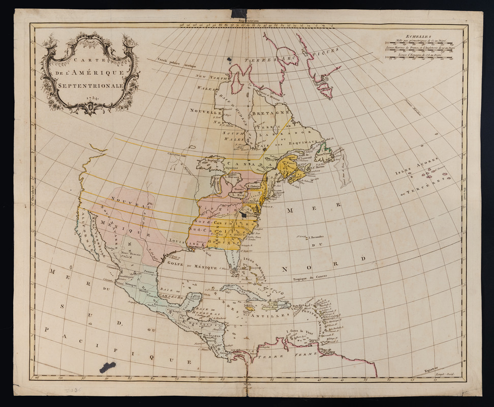
Carte de l'Amérique septentrionale, 1754
This map is also available in American Revolutionary Geographies Online (ARGO), a collections portal especially built for material relating to the American Revolutionary War Era. Visit ARGO to learn more about this item and explore the historical geography of North America in the late eighteenth century.
Item Information
- Title:
- Carte de l'Amérique septentrionale, 1754
- Creator:
- Palairet, Jean, 1697-1774
- Date:
-
[1755]
- Format:
-
Maps/Atlases
- Location:
- Massachusetts Historical Society
- Collection (local):
-
Massachusetts Historical Society Collection
- Subjects:
-
North America--Maps--Early works to 1800
- Places:
-
North America (area)
- Extent:
- 1 map : col. ; 48 x 58 cm.
- Terms of Use:
-
No known copyright restrictions.
This work is licensed for use under a Creative Commons Attribution Non-Commercial Share Alike License (CC BY-NC-SA).

- Publisher:
-
Londres :
[s.n.]
- Scale:
-
Scale ca. 1:15,000,000
- Language:
-
French
- Catalog Record:
-
http://balthazaar.masshist.org/cgi-bin/Pwebrecon.cgi?DB=local&BBID=186749
- Notes:
-
Hand colored.
Relief shown pictorially.
From the author's Atlas méthodique. 1755.
Shows boundaries, some cities and towns, forts, and Indian tribal territory.
- Notes (date):
-
This date is inferred.
- LCCN:
-
73695115

![[A map of the east coast of America from Newfoundland to the Bay of Honduras]](https://bpldcassets.blob.core.windows.net/derivatives/images/commonwealth:hx11z584h/image_thumbnail_300.jpg)


