An accurate map of North America : Describing and distinguishing the British and Spanish dominions of this great continent; according to the definitive treaty concluded at Paris 10th Feby. 1763. Also all the West India Islands belonging to and possessed by the several European princes and states
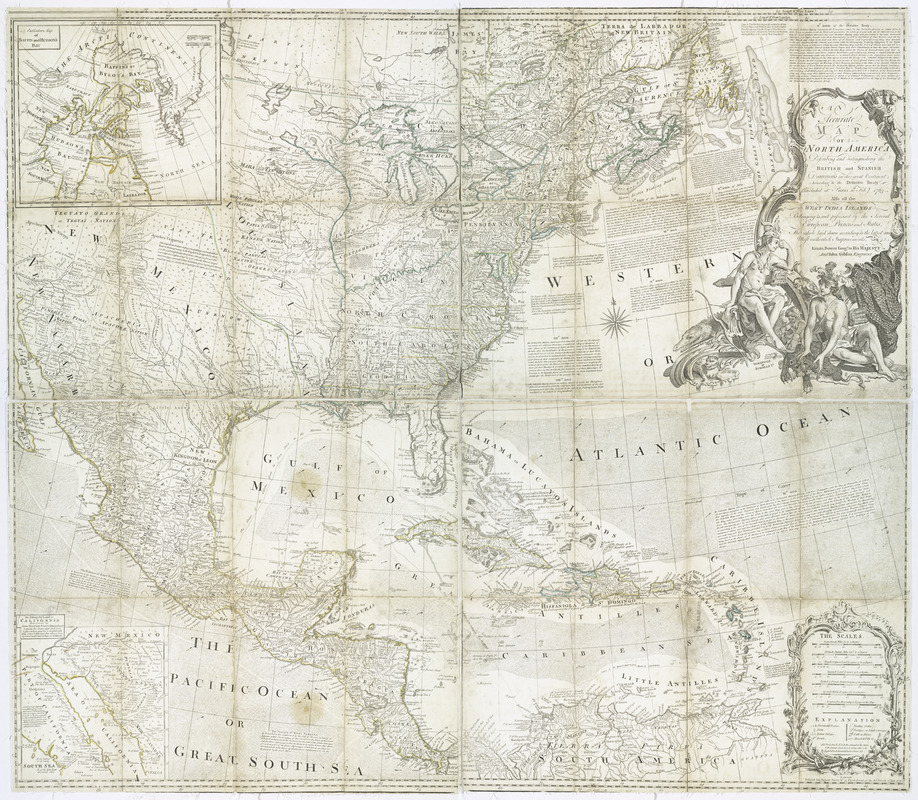
This map is also available in American Revolutionary Geographies Online (ARGO), a collections portal especially built for material relating to the American Revolutionary War Era. Visit ARGO to learn more about this item and explore the historical geography of North America in the late eighteenth century.
Item Information
- Title:
- An accurate map of North America : Describing and distinguishing the British and Spanish dominions of this great continent; according to the definitive treaty concluded at Paris 10th Feby. 1763. Also all the West India Islands belonging to and possessed by the several European princes and states
- Creator:
- Bowen, Emanuel, -1767
- Contributor:
- Sayer, Robert, 1725-1794
- Contributor:
- Gibson, J. (John), active 1750-1792
- Name on Item:
-
The whole laid down according to the latest and most authentick improvements, by Eman. Bowen, geogr. to His Majesty and John Gibson, engraver.
- Date:
-
1775
- Format:
-
Maps/Atlases
- Location:
- New York Public Library
- Collection (local):
-
Maps of North America
- Subjects:
-
North America--Maps--Early works to 1800
British--America--Maps--Early works to 1800
- Places:
-
North America (area)
- Extent:
- col. map 103 x 118 cm.
- Terms of Use:
-
No known copyright restrictions.
This work is licensed for use under a Creative Commons Attribution Non-Commercial Share Alike License (CC BY-NC-SA).

- Publisher:
-
London :
Printed for Robert Sayer
- Scale:
-
Scale ca. 1:550,000
- Language:
-
English
- Catalog Record:
-
https://digitalcollections.nypl.org/items/510d47da-ee86-a3d9-e040-e00a18064a99
- Notes:
-
Hand colored.
Relief shown pictorially.
"Longit. w. from London."
From Thomas Jefferys' American atlas. 1775. no. 5, 6.
Includes historical notes, excerpts from the treaty of 1763, and insets of "A particular map of Baffin and Hudson's Bay," and "The passage by land to California."
- LCCN:
-
74694274


