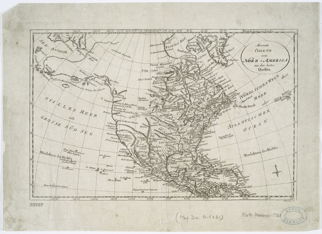
Acurate charte von Nord-America : aus dem besten quellen
This map is also available in American Revolutionary Geographies Online (ARGO), a collections portal especially built for material relating to the American Revolutionary War Era. Visit ARGO to learn more about this item and explore the historical geography of North America in the late eighteenth century.
Item Information
- Title:
- Acurate charte von Nord-America : aus dem besten quellen
- Creator:
- Frentzel, Georg Friedrich Jonas, 1754?-1799
- Name on Item:
-
Frentzel sc.
- Date:
-
[1776?]
- Format:
-
Maps/Atlases
- Location:
- New York Public Library
- Collection (local):
-
Maps of North America
- Subjects:
-
North America--Maps--Early works to 1800
- Places:
-
North America (area)
- Extent:
- 1 map ; 24 x 38 cm.
- Terms of Use:
-
No known copyright restrictions.
This work is licensed for use under a Creative Commons Attribution Non-Commercial Share Alike License (CC BY-NC-SA).

- Publisher:
-
Leipzig? :
[s.n.]
- Scale:
-
Scale [ca. 1:40,000,000]
- Language:
-
German
- Catalog Record:
-
https://digitalcollections.nypl.org/items/510d47da-f0e6-a3d9-e040-e00a18064a99
- Notes:
-
Relief shown by hachures.
Prime meridian: London.
Watermark.


