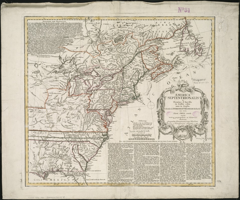
America Septentrionalis a Domino d'Anville in Galliis edita nunc in Anglia : Coloniis in interiorem Virginiam deductis nec non Fluvii Ohio cursu aucta notisque geographicis et historicis illustrata
This map is also available in American Revolutionary Geographies Online (ARGO), a collections portal especially built for material relating to the American Revolutionary War Era. Visit ARGO to learn more about this item and explore the historical geography of North America in the late eighteenth century.
Item Information
- Title:
- America Septentrionalis a Domino d'Anville in Galliis edita nunc in Anglia : Coloniis in interiorem Virginiam deductis nec non Fluvii Ohio cursu aucta notisque geographicis et historicis illustrata
- Creator:
- Homann Erben (Firm)
- Name on Item:
-
Sumptibus Homannianorum Heredum.
- Date:
-
1756
- Format:
-
Maps/Atlases
- Location:
-
Boston Public Library
Norman B. Leventhal Map & Education Center - Collection (local):
-
Norman B. Leventhal Map & Education Center Collection
- Subjects:
-
North America--Maps--Early works to 1800
- Places:
-
North America (area)
- Extent:
- 1 map : col. ; 46 x 50 cm.
- Terms of Use:
-
No known copyright restrictions.
No known restrictions on use.
- Publisher:
-
Noribergæ :
Homannianorum Heredum
- Scale:
-
Scale ca. 1:6,300,000.
- Language:
-
Latin
German
- Notes:
-
Relief shown pictorially.
Prime meridian: Ferro and London.
Place names and descriptive notes in English.
Georgia's boundary extends from St. John's River up "Alatamaha" River, along the lowest tributary shown, northward just to the west of "Cahuita," eastward just to the north of "Keeowee," and along the "Savana" River to the sea.
Includes German text relating to English and French territorial claims.
- Identifier:
-
06_01_006091
- Call #:
-
G3300 1756 .H6
- Barcode:
-
39999059019578
- LCCN:
-
74692881


