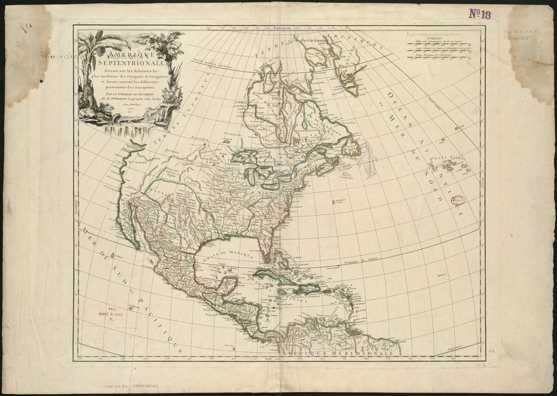
Amérique Septentrionale : dressée sur les relations les plus modernes des voyageurs et navigateurs, et divisée suivant les differentes possessions des Européens
This map is also available in American Revolutionary Geographies Online (ARGO), a collections portal especially built for material relating to the American Revolutionary War Era. Visit ARGO to learn more about this item and explore the historical geography of North America in the late eighteenth century.
Item Information
- Title:
- Amérique Septentrionale : dressée sur les relations les plus modernes des voyageurs et navigateurs, et divisée suivant les differentes possessions des Européens
- Creator:
- Robert de Vaugondy, Didier, 1723-1786
- Name on Item:
-
par le Sr. Robert de Vaugondy, fils de Mr. Robert Géographe ordin. du Roy.
- Date:
-
1750
- Format:
-
Maps/Atlases
- Location:
-
Boston Public Library
Norman B. Leventhal Map & Education Center - Collection (local):
-
Norman B. Leventhal Map & Education Center Collection
- Subjects:
-
North America--Maps--Early works to 1800
- Places:
-
North America (area)
- Extent:
- 1 map : col. ; 47 x 58 cm.
- Terms of Use:
-
No known copyright restrictions.
No known restrictions on use.
- Publisher:
-
[Paris] :
Robert de Vaugondy
- Scale:
-
Scale ca. 1:16,000,000.
- Language:
-
French
- Notes:
-
Relief shown pictorially.
Appears in his Atlas universel ... Paris, 1757-58, pl. 97.
- Identifier:
-
06_01_006077
- Call #:
-
G3300 1750 .R6
- Barcode:
-
39999059019404


