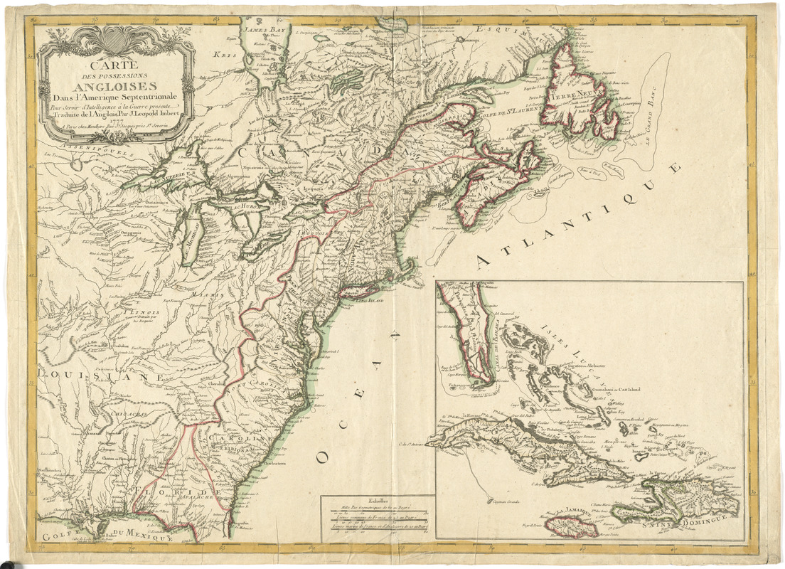
Carte des possessions angloises dans l'Amerique Septentrionale pour servir d'intelligence à la guerre presente traduite de l'Anglois
This map is also available in American Revolutionary Geographies Online (ARGO), a collections portal especially built for material relating to the American Revolutionary War Era. Visit ARGO to learn more about this item and explore the historical geography of North America in the late eighteenth century.
Item Information
- Title:
- Carte des possessions angloises dans l'Amerique Septentrionale pour servir d'intelligence à la guerre presente traduite de l'Anglois
- Creator:
- Imbert, J. Leopold
- Publisher:
- Mondhare (Firm)
- Name on Item:
-
par J. Leopold Imbert.
- Date:
-
1777
- Format:
-
Maps/Atlases
- Location:
- George Washington's Mount Vernon
- Collection (local):
-
Richard H. Brown Revolutionary War Map Collection at Mount Vernon
- Subjects:
-
North America--Maps--Early works to 1800
- Places:
-
North America (area)
- Extent:
- 1 map : hand col. ; 53 x 72 cm.
- Terms of Use:
-
No known copyright restrictions.
This work is licensed for use under a Creative Commons Attribution Non-Commercial Share Alike License (CC BY-NC-SA).

- Publisher:
-
Paris :
Chez Mondhare
- Scale:
-
Scale [ca. 1:5,100,000]
- Language:
-
French
- Catalog Record:
-
MVLA record
- Notes:
-
Shows states, towns and cities, and Indian territories and villages.
Relief shown pictorially.
Inset: [Florida peninsula and Caribbean islands].
Ornamental title cartouche.
In French.
- Identifier:
-
06_01_008212


