Search Constraints
Search Results


112. Haiti


115. East Asia


119. Asia


122. Waterfront skyline


134. Shadow analysis


143. James Hayes Park


146. We must have order


156. Conceptual plan


160. Conceptual plan


164. Downtown Boston


172. Union Park


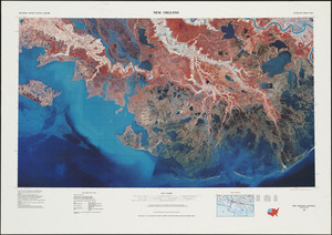
178. New Orleans


182. Southern Asia


184. British Isles


195. T system map


197. Parcel D-10


