Berkeley Street community garden

Item Information
- Title:
- Berkeley Street community garden
- Title (alt.):
-
Berkely Street community garden
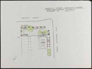
- Description:
-
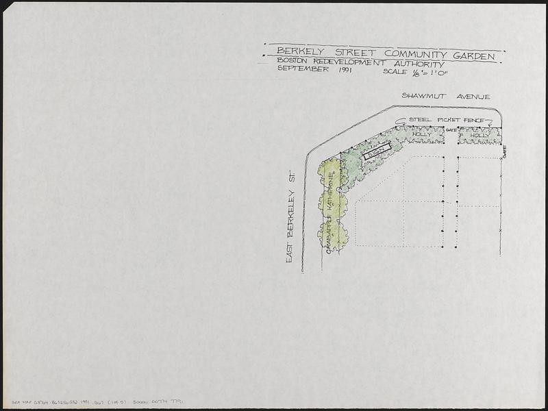
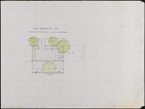
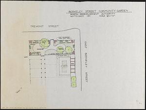
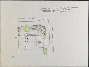
5 manuscript maps in ink and pencil showing possible layouts of the Berkeley Street community garden. 3 maps show the corner of Tremont Street and East Berkeley Street, 1 map shows the garden in the middle of East Berkeley Street, and 1 map shows the corner of East Berkeley Street and Shawmut Avenue.
- Cartographer:
- Boston Redevelopment Authority
- Name on Item:
-
Boston Redevelopment Authority
- Date:
-
September 1991
- Format:
-
Maps/Atlases
- Genre:
-
Manuscript maps
- Location:
-
Boston Public Library
Norman B. Leventhal Map & Education Center - Collection (local):
-
Norman B. Leventhal Map & Education Center Collection
- Series:
- Boston Redevelopment Authority Maps & Manuscript Plans Collection
- Subjects:
-
Community gardens--Massachusetts--Boston--Maps
City planning--Massachusetts--Boston--Maps
Urban renewal--Massachusetts--Boston--Maps
South End (Boston, Mass.)--Planning--Maps
- Places:
-
MassachusettsSuffolk (county)BostonSouth End
- Extent:
- 5 manuscript maps : hand colored ; 46 x 61 cm
- Terms of Use:
-
No known copyright restrictions.
No known restrictions on use.
- Scale:
-
Scale 1:96. 1/8" = 1'0"
- Language:
-
English
- Notes:
-
Shows types of gardens, beds, fencing and trees.
- Identifier:
-
06_01_017846A
06_01_017846B
06_01_017846C
06_01_017846D
06_01_017846E
- Call #:
-
BRA MAP FOLDER 17
- Barcode:
-
30000007747791


