Sears Park conceptual site plan with historic waterway

Item Information
- Title:
- Sears Park conceptual site plan with historic waterway
- Title (alt.):
-
Sears Park vicinity 1892 vs. 1989
- Description:
-
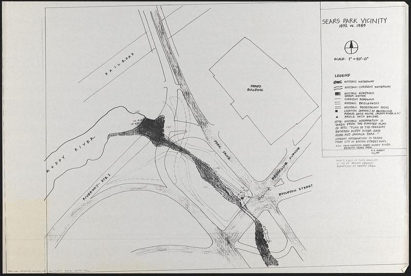
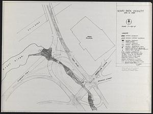
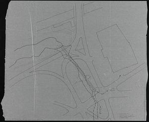
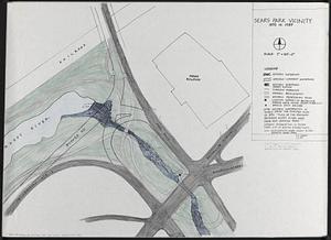
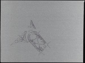
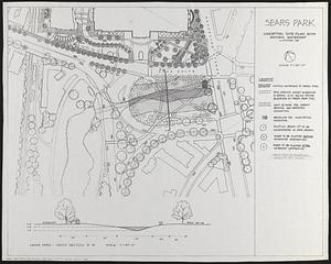
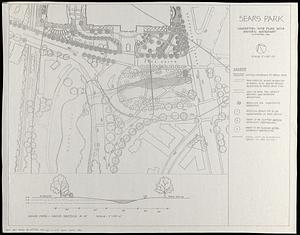
A set of drafts and final site plan of Sears Park at the intersection of Brookline Avenue and Park Drive in Fenway. Map 1 is a photocopy of a manuscript map outlining buildings, roads, railroad, paths and Muddy River, with some widths. Map 2 is photocopy of the same map as map 1 with manuscript annotations and corrections. Map 3 is a manuscript map overlay in ink on tracing paper with added buildings, paths, and widths. Map 4 is a photocopy of map 2, with manuscript additions of paths and roads in pencil, ink, and colored. Map 5 is a manuscript map overlay in ink on tracing paper showing trees in Sears Park. Map 6 is finalized version with manuscript annotations in pencil. Map 7 is the final map showing historic waterways, twin conduits, limit of work for conduit removal and waterway excavation, Brookline Ave. subsurface gatehouse, existing trees to be incorporated in park design, trees to be planted before waterway restoration, trees to be planted after waterway restoration and FEMA limit of floodplain.
- Publisher:
- Boston Redevelopment Authority
- Cartographer:
- Sweesy, Robin A.
- Date:
-
November 1989
- Format:
-
Maps/Atlases
- Genre:
-
Manuscript maps
- Location:
-
Boston Public Library
Norman B. Leventhal Map & Education Center - Collection (local):
-
Norman B. Leventhal Map & Education Center Collection
- Series:
- Boston Redevelopment Authority Maps & Manuscript Plans Collection
- Subjects:
-
Parks--Massachusetts--Boston--Maps
Landscape gardening--Massachusetts--Boston--Maps
City planning--Massachusetts--Boston--Maps
Fenway (Boston, Mass.)--Maps
Fenway (Boston, Mass.)--History--Maps
- Places:
-
MassachusettsSuffolk (county)BostonFens
- Extent:
- 7 maps : hand colored ; sheets 61 x 78 cm
- Terms of Use:
-
No known copyright restrictions.
No known restrictions on use.
- Publisher:
-
[Boston] :
[Boston Redevelopment Authority]
- Scale:
-
Scale 1:600. 1" = 50'-0"
- Language:
-
English
- Notes:
-
Maps 1-5 on base map titled Sears Park vicinity 1892 vs. 1989 / R.E. Sweesy 11/6/89.
Maps 6 and 7 oriented with north to the upper left.
Includes cross section of elevation from Riverway to Park Drive.
Note on Sears Park vicinity map: Historic information is taken from the Olmsted plan of 1892: "Plan of the parkway between Muddy River gate house and Jamaica Park." Current information is taken from city of Boston street maps.
- Identifier:
-
06_01_017855A
06_01_017855B
06_01_017855C
06_01_017855D
06_01_017855E
06_01_017855F
06_01_017855G
- Call #:
-
BRA MAP FOLDER 9
- Barcode:
-
30000007747806


