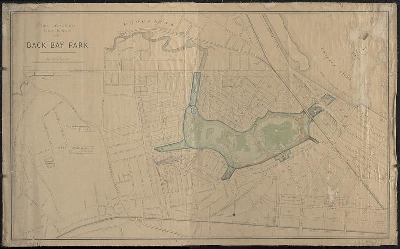
Back Bay park
Item Information
- Title:
- Back Bay park
- Description:
-
Manuscript plan of Back Bay Fens and surrounding area showing layout and drainage, drawn on a map published by the Park Department in 1877. Derived from Olmsted's 1878 plan of the park.
- Cartographer:
- Boston (Mass.). Department of Parks
- Name on Item:
-
Parks Department City of Boston
- Date:
-
[1880]
- Format:
-
Maps/Atlases
- Genre:
-
Manuscript maps
- Location:
-
Boston Public Library
Norman B. Leventhal Map & Education Center - Collection (local):
-
Norman B. Leventhal Map & Education Center Collection
- Subjects:
-
Fenway (Boston, Mass.)--Maps
Parks--Massachusetts--Boston--Maps
City planning--Massachusetts--Boston--Maps
Sewerage--Massachusetts--Boston--Maps
- Places:
-
MassachusettsSuffolk (county)BostonFens
- Extent:
- 1 manuscript map : hand color, backed on cloth ; 81 x 135 cm
- Terms of Use:
-
No known copyright restrictions.
No known restrictions on use.
- Publisher:
-
Boston :
Park Department
- Scale:
-
Scale 1:2,400. Scale 200 feet to an inch
- Language:
-
English
- Notes:
-
Oriented with north to the upper right.
Manuscript note in ink: Made for J.B. Kendall dated Mar 4 1880. Park interior colored marsh green. Drew trees. Water lines with blue. Red lines estate as shown here.
Manuscript note in ink: Made colored plan for J.T. Eldridge April 13 1880 but dated it March 1880 showing lots numbered and approximate areas and on writing paper gave list of owners. This was to take the place of one furnished him.
Lacking list of lots and owners.
Includes property stamps from Fuller & Whitney, numbered 754 1/2.
- Notes (date):
-
This date is inferred.
- Identifier:
-
06_01_018547
- Call #:
-
G3764.B6:2F4G52 1880 .B33
- Barcode:
-
39999085963476


