Massachusetts Bay Transportation Authority system map

Item Information
- Title:
- Massachusetts Bay Transportation Authority system map
- Cartographer:
- General Drafting Company
- Publisher:
- Massachusetts Bay Transportation Authority
- Name on Item:
-
graphic revisions by General Drafting Co., Inc.
- Date:
-
1988
- Format:
-
Maps/Atlases
- Location:
-
Boston Public Library
Norman B. Leventhal Map & Education Center - Collection (local):
-
Norman B. Leventhal Map & Education Center Collection
- Subjects:
-
Local transit--Massachusetts--Boston--Maps
Subways--Massachusetts--Boston--Maps
Bus rapid transit--Massachusetts--Boston--Maps
Boston (Mass.)--Maps
Massachusetts Bay Transportation Authority
- Places:
-
MassachusettsSuffolk (county)Boston
- Extent:
- 1 map : color
- Terms of Use:
-
No known copyright restrictions.
No known restrictions on use.
- Publisher:
-
Boston :
Massachusetts Bay Transportation Authority
- Language:
-
English
- Notes:
-
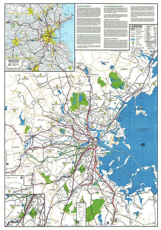
Includes text and 4 insets.
Insets: Commuter rail service area -- A. [Framingham-Natick] -- [Forest Hills area] -- B. [Randolph-Avon-Brockton].
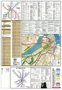
On verso: T rapid transit lines diagram, subway and bus schedules, points of interest, text, map of central Boston and T commuter rail diagram.
- Identifier:
-
1988-MBTA-System-Map
1988-MBTA-System-Cover
- Call #:
-
G3764.B6P33 svar .B67
- Barcode:
-
39999065669267


