Washington Street boulevard study : proposed fabric

Item Information
- Title:
- Washington Street boulevard study : proposed fabric
- Description:
-
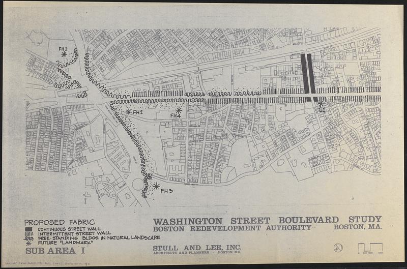
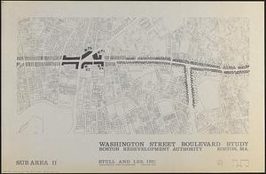
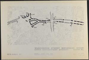
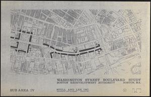
Maps likely prepared for a report on future urban design/development for Washington Street in Boston's South End, Roxbury and Jamaica Plain neighborhoods, by Stull and Lee, Inc. for the Boston Redevelopment Authority approximately 1990. This set of maps does not appear in the report.
- Publisher:
- Boston Redevelopment Authority
- Cartographer:
- Stull and Lee, Inc.
- Name on Item:
-
Boston Redevelopment Authority ; Stull and Lee, Inc.
- Date:
-
[ca. 1990]
- Format:
-
Maps/Atlases
- Location:
-
Boston Public Library
Norman B. Leventhal Map & Education Center - Collection (local):
-
Norman B. Leventhal Map & Education Center Collection
- Series:
- Boston Redevelopment Authority Maps & Manuscript Plans Collection
- Subjects:
-
City planning--Massachusetts--Boston--Maps
Urban renewal--Massachusetts--Boston--Maps
Washington Street (Boston, Mass.)--Maps
- Places:
-
MassachusettsSuffolk (county)BostonSouth End
MassachusettsSuffolk (county)BostonRoxbury
MassachusettsSuffolk (county)BostonJamaica Plain
- Extent:
- 5 sheets : maps, illustrations ; sheets 58 x 86 cm
- Terms of Use:
-
No known copyright restrictions.
No known restrictions on use.
- Publisher:
-
Boston :
Boston Redevelopment Authority
- Scale:
-
Scale approximately 1:2,400
- Language:
-
English
- Table of Contents:
-
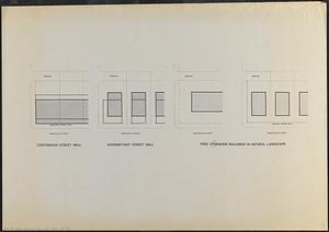
Sub area I
sub area II
sub area III
sub area IV
[illustrations of street walls and natural landscape]
- Notes:
-
Indicates continuous street wall, intermittent street wall, free standing buildings in natural landscape and future "landmark."
Oriented with north to the upper right.
Base map shows streets, plats and building footprints.
- Identifier:
-
06_01_017851A
06_01_017851B
06_01_017851C
06_01_017851D
06_01_017851E
- Call #:
-
BRA MAP FOLDER 21
- Barcode:
-
30000007747810


