Washington Street boulevard study : corridor wide urban design strategy

Item Information
- Title:
- Washington Street boulevard study : corridor wide urban design strategy
- Description:
-
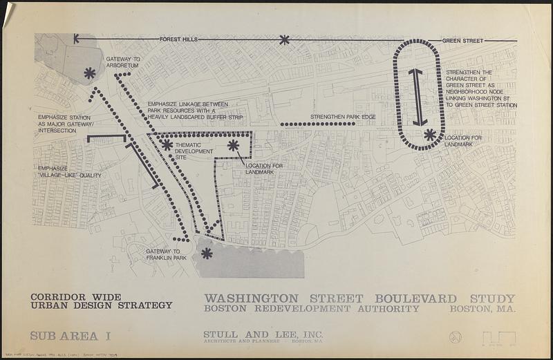
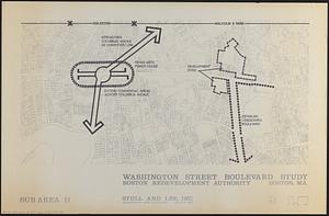
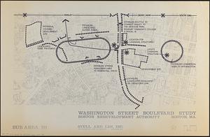
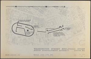
Draft of maps published in a report on future urban design/development for Washington Street in Boston's South End, Roxbury and Jamaica Plain neighborhoods, prepared by Stull and Lee, Inc. for the Boston Redevelopment Authority approximately 1990.
- Publisher:
- Boston Redevelopment Authority
- Cartographer:
- Stull and Lee, Inc.
- Name on Item:
-
Boston Redevelopment Authority ; Stull and Lee, Inc
- Date:
-
[ca. 1990]
- Format:
-
Maps/Atlases
- Location:
-
Boston Public Library
Norman B. Leventhal Map & Education Center - Collection (local):
-
Norman B. Leventhal Map & Education Center Collection
- Series:
- Boston Redevelopment Authority Maps & Manuscript Plans Collection
- Subjects:
-
City planning--Massachusetts--Boston--Maps
Urban renewal--Massachusetts--Boston--Maps
Washington Street (Boston, Mass.)--Maps
- Places:
-
MassachusettsSuffolk (county)BostonSouth End
MassachusettsSuffolk (county)BostonRoxbury
MassachusettsSuffolk (county)BostonJamaica Plain
- Extent:
- 4 maps ; on sheets 57 x 87 cm
- Terms of Use:
-
No known copyright restrictions.
No known restrictions on use.
- Publisher:
-
Boston :
Boston Redevelopment Authority
- Scale:
-
Scale approximately 1:2,400
- Language:
-
English
- Table of Contents:
-
Sub area I
sub area II
sub area III
sub area IV
- Notes:
-
Oriented with north to the upper right.
Base map shows streets, plats and building footprints.
Includes notes about areas and development strategies.
- Identifier:
-
06_01_017853A
06_01_017853B
06_01_017853C
06_01_017853D
- Call #:
-
BRA MAP FOLDER 22
- Barcode:
-
30000007747809


