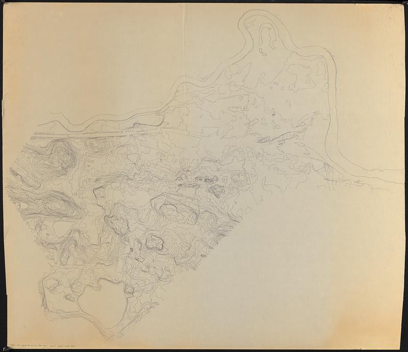
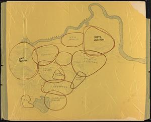
Topographic map of Brighton and Allston

Item Information
- Title:
- Topographic map of Brighton and Allston
- Description:
-
Photocopy of a manuscript topographic map of Brighton and Allston and a manuscript map overlay on yellow tissue showing smaller neighborhoods, the Charles River and Chestnut Hill Reservoir.
- Cartographer:
- Boston Redevelopment Authority
- Date:
-
[ca. 1990–1999]
- Format:
-
Maps/Atlases
- Genre:
-
Topographic maps
Manuscript maps
- Location:
-
Boston Public Library
Norman B. Leventhal Map & Education Center - Collection (local):
-
Norman B. Leventhal Map & Education Center Collection
- Series:
- Boston Redevelopment Authority Maps & Manuscript Plans Collection
- Subjects:
-
Neighborhoods--Massachusetts--Boston--Maps
Allston (Boston, Mass.)--Maps
Brighton (Boston, Mass.)--Maps
- Places:
-
MassachusettsSuffolk (county)BostonAllston
MassachusettsSuffolk (county)BostonBrighton
- Extent:
- 2 maps : color ; sheets 108 x 123 cm and 106 x 134 cm
- Terms of Use:
-
No known copyright restrictions.
No known restrictions on use.
- Publisher:
-
[Boston] :
[Boston Redevelopment Authority]
- Scale:
-
Scale not given
- Language:
-
English
- Notes:
-
Relief shown by contours.
Manuscript overlay drawn in marker.
- Identifier:
-
06_01_017849A
06_01_017849B
- Call #:
-
BRA MAP FOLDER 3
- Barcode:
-
30000007747808


