Mass pike air rights study

Item Information
- Title:
- Mass pike air rights study
- Description:
-
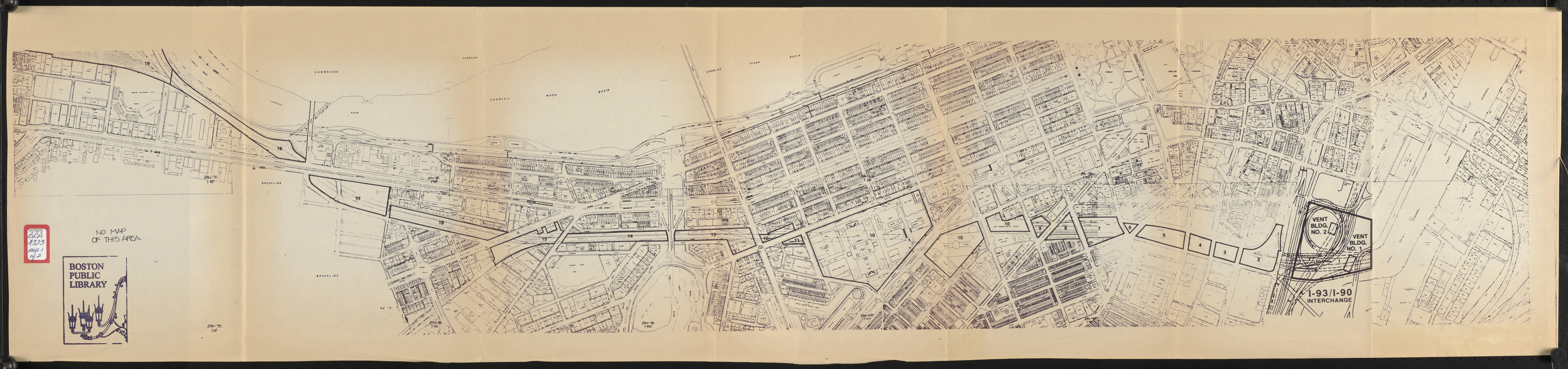
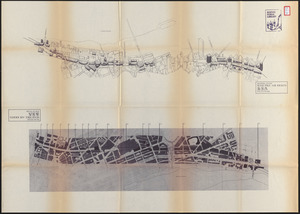
Accompanies an examination of issues involved in air rights development above the MA Turnpike in downtown Boston.
- Cartographer:
- Boston Society of Architects
- Date:
-
1989
- Format:
-
Maps/Atlases
- Location:
-
Boston Public Library
Central Library in Copley Square - Collection (local):
-
Boston Public Library Collection
- Subjects:
-
Massachusetts Turnpike (Boston, Mass.)--Maps
City planning--Massachusetts--Boston--Maps
Boston (Mass.)--Maps
Buildings--Height Restrictions--Massachusetts--Boston--Maps
- Places:
-
Suffolk (county)Boston
- Extent:
- 3 maps on 2 sheets ; 32 x 138 cm and sheet 77 x 107 cm
- Terms of Use:
-
No known copyright restrictions.
No known restrictions on use.
- Publisher:
-
[Boston] :
[Boston Society of Architects]
- Language:
-
English
- Table of Contents:
-
[Massachusetts turnpike from Back Bay to Allston]
Massing study ; Plan study
- Catalog Record:
-
http://bpl.bibliocommons.com/item/show/1012759075
- Identifier:
-
06_01_017194
06_01_017195
- Call #:
-
BRA/4323 MAPS
- Barcode:
-
mq6309501


