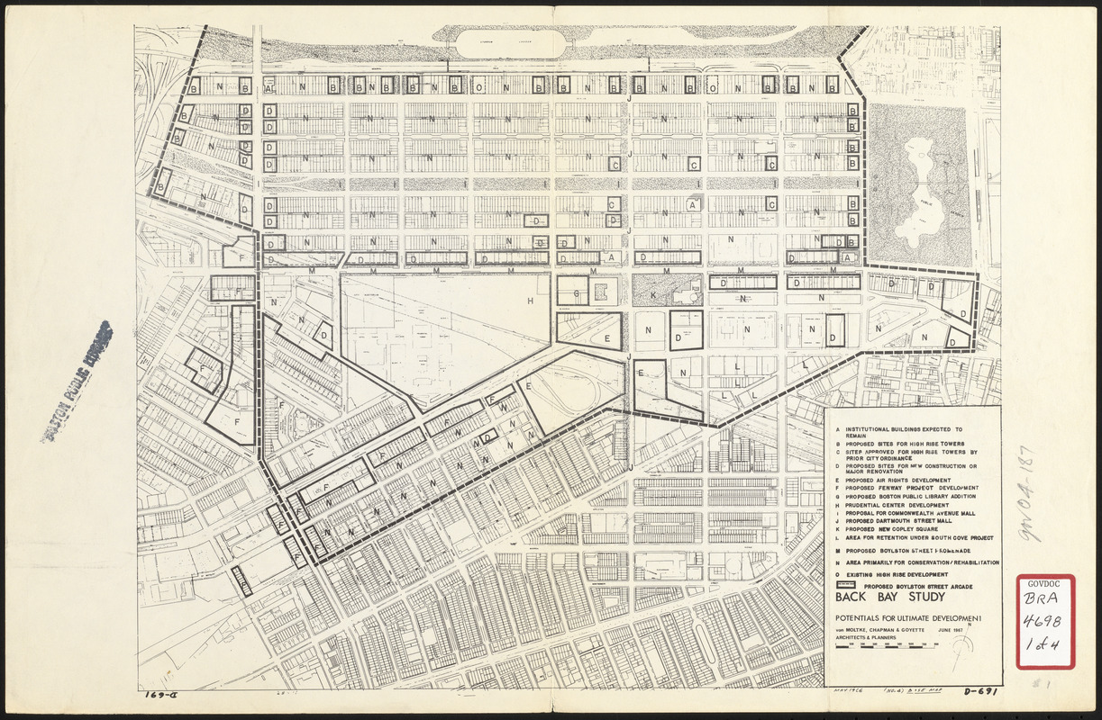
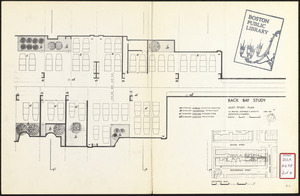
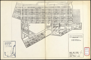
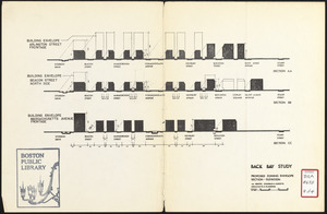
Back Bay study

Item Information
- Title:
- Back Bay study
- Description:
-
Accompanies a development plan for Back Bay.
- Cartographer:
- Von Moltke, Chapman and Goyette
- Date:
-
June 1967
- Format:
-
Maps/Atlases
- Location:
-
Boston Public Library
Central Library in Copley Square - Collection (local):
-
Boston Public Library Collection
- Subjects:
-
Alleys--Massachusetts--Boston--Maps
Arlington Street (Boston, Mass.)--Maps
Buildings--Massachusetts--Boston--Maps
Commonwealth Avenue (Boston, Mass.)--Maps
Dartmouth Street (Boston, Mass.)--Maps
Massachusetts Avenue (Boston, Mass.)--Maps
City planning--Massachusetts--Boston--Maps
Zoning--Massachusetts--Boston--Maps
Boylston Street (Boston, Mass.)--Maps
Back Bay (Boston, Mass.)--Maps
Buildings--Height Restrictions--Massachusetts--Boston--Maps
Prudential Center (Boston, Mass.)
Boston Public Library
- Places:
-
MassachusettsSuffolk (county)BostonBack Bay
- Extent:
- 1 map ; 27 x 35 cm
- Terms of Use:
-
No known copyright restrictions.
No known restrictions on use.
- Publisher:
-
[Boston] :
Von Moltke, Chapman and Goyette
- Scale:
-
Scales differ
- Language:
-
English
- Catalog Record:
-
http://bpl.bibliocommons.com/item/show/1031697075
- Notes:
-
Oriented with north to the upper right.
Manuscript in lower right: May 1966 (no. 4) base map.
- Identifier:
-
06_01_017174A
06_01_017174B
06_01_017174C
06_01_017174D
- Call #:
-
BRA/4698
- Barcode:
-
mq6328367


