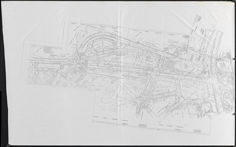
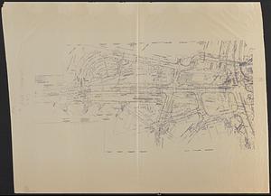
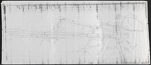
Infrastructure around Tobin Bridge/US route 1 in Charlestown

Item Information
- Title:
- Infrastructure around Tobin Bridge/US route 1 in Charlestown
- Cartographer:
- Boston Redevelopment Authority
- Date:
-
[1992]
- Format:
-
Maps/Atlases
- Location:
-
Boston Public Library
Norman B. Leventhal Map & Education Center - Collection (local):
-
Norman B. Leventhal Map & Education Center Collection
- Series:
- Boston Redevelopment Authority Maps & Manuscript Plans Collection
- Subjects:
-
Charlestown (Boston, Mass.)--Maps
Maurice J. Tobin Memorial Bridge (Mass.)--Maps
United States Highway 1--Maps
Buildings--Massachusetts--Boston--Maps
Highway engineering--Massachusetts--Boston--Maps
Roads--Massachusetts--Boston--Maps
Traffic flow--Massachusetts--Boston--Maps
- Places:
-
MassachusettsSuffolk (county)BostonCharlestown
M J Tobin Memorial Bridge
- Extent:
- 3 map photocopies ; on sheets 108 x 214 cm or smaller
- Terms of Use:
-
No known copyright restrictions.
No known restrictions on use.
- Publisher:
-
[Boston] :
[Boston Redevelopment Authority]
- Language:
-
English
- Notes:
-
Photocopies of maps showing details of roads, traffic, tunnels, and buildings in Charlestown around the Tobin Bridge/US route 1 area.
Oriented with north to the lower left.
One map includes manuscript annotations in pencil and ink, with notes "To Ann Johnson CNY" and "May 1992 CANA base."
- Notes (date):
-
This date is inferred.
- Identifier:
-
06_01_018600
- Call #:
-
BRA MAP FOLDER 48
- Barcode:
-
30000008307633


