Open space management program index map
Item Information
- Title:
- Open space management program index map
- Description:
-
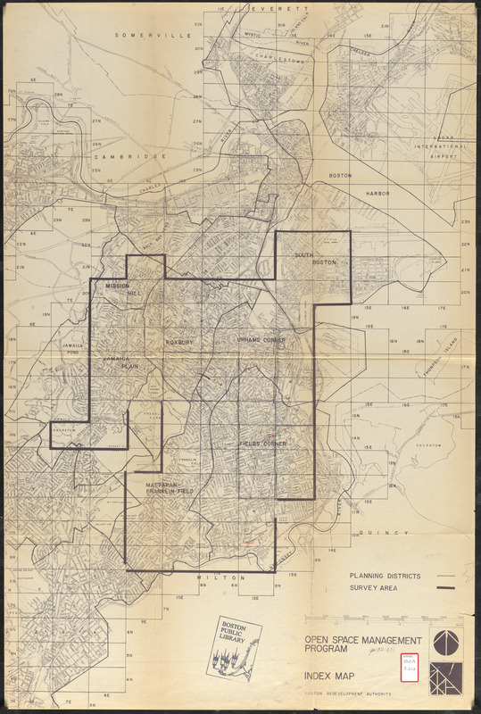
Shows boundaries of the area surveyed in Boston for open space planning purposes. Includes parts of Mission Hill, Roxbury, Jamaica Plain, Uphams Corner, South Boston, Fields Corner and Mattapan/Franklin Field.
- Cartographer:
- Boston Redevelopment Authority
- Date:
-
[ca. 1987]
- Format:
-
Maps/Atlases
- Location:
-
Boston Public Library
Central Library in Copley Square - Collection (local):
-
Boston Public Library Collection
- Subjects:
-
Open spaces--Massachusetts--Boston--Maps
Boston (Mass.)--Maps
City planning--Massachusetts--Boston--Maps
- Places:
-
Suffolk (county)Boston
- Extent:
- 1 map : hand colored ; 92 x 61 cm
- Terms of Use:
-
No known copyright restrictions.
No known restrictions on use.
- Publisher:
-
[Boston] :
[Boston Redevelopment Authority]
- Scale:
-
Scale approximately 1:19,800
- Language:
-
English
- Catalog Record:
-
http://bpl.bibliocommons.com/item/show/1034753075
- Identifier:
-
06_01_017253x
- Call #:
-
BRA/3212
- Barcode:
-
39999065833822


