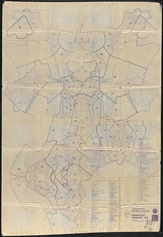
Neighborhood boundaries 1980
Item Information
- Title:
- Neighborhood boundaries 1980
- Cartographer:
- Boston Redevelopment Authority
- Name on Item:
-
Neighborhood Statistics Program, Boston Redevelopment Authority
- Date:
-
October 1983
- Format:
-
Maps/Atlases
- Location:
-
Boston Public Library
Central Library in Copley Square - Collection (local):
-
Boston Public Library Collection
- Subjects:
-
Boston (Mass.)--Maps
City planning districts--Massachusetts--Boston--Maps
- Places:
-
Suffolk (county)Boston
- Extent:
- 1 map ; 158 x 106 cm
- Terms of Use:
-
No known copyright restrictions.
No known restrictions on use.
- Publisher:
-
Boston :
Boston Redevelopment Authority
- Scale:
-
Scale approximately 1:14,400
- Language:
-
English
- Notes:
-
Shows neighborhood statistical areas, B.R.A. Research Department planning district boundaries, and Neighborhood Development & Employment Agency area boundaries.
Inset: Harbor Islands.
- Identifier:
-
06_01_017800
- Call #:
-
M3.B16/RA/83.27
- Barcode:
-
39999065863605


