North Atlantic Ocean, West Indies
Item Information
- Title:
- North Atlantic Ocean, West Indies
- Description:
-
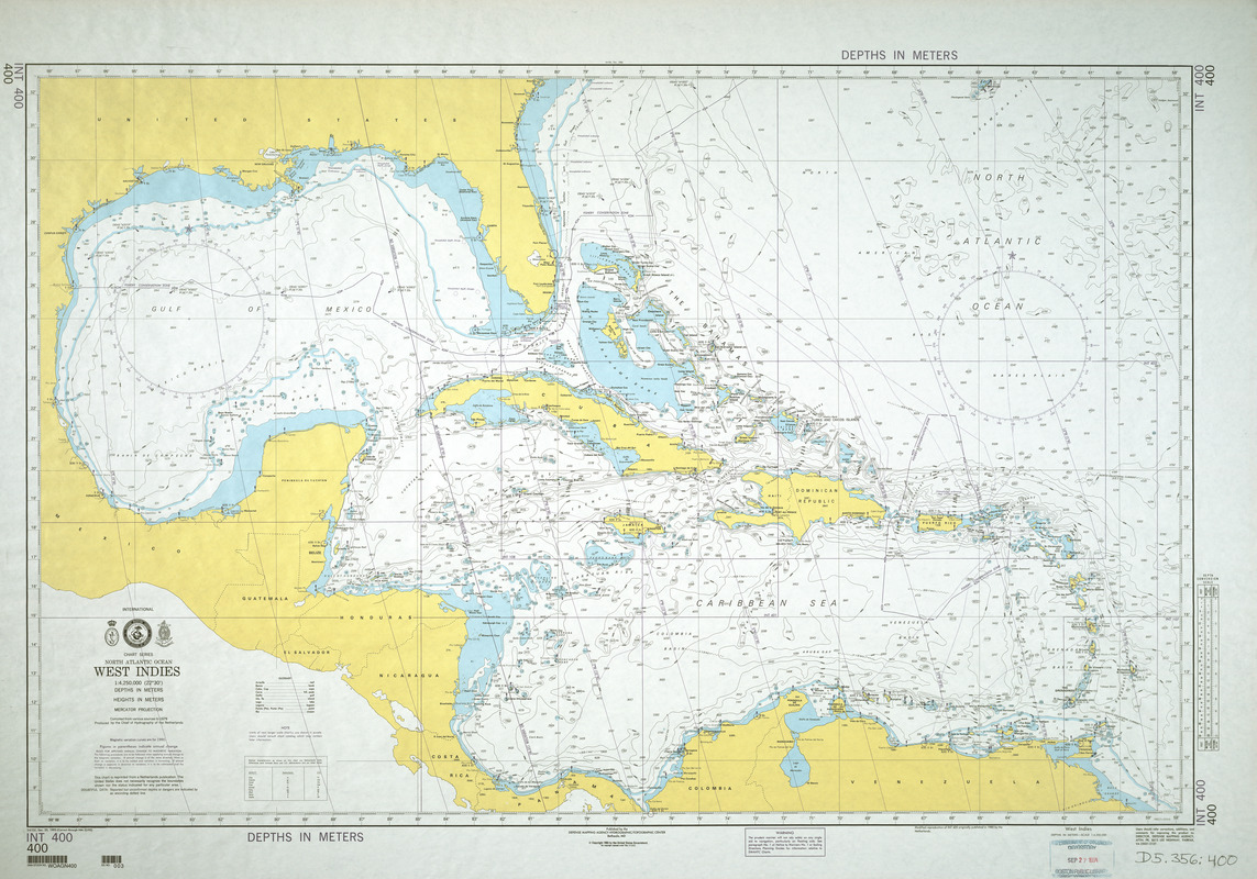
Using the latest advances in modern technology for gathering depth soundings and generating automated cartography, this chart was prepared primarily for navigational purposes, testifying to sailors' continual quest for obtaining the most reliable information since the 16th century for navigating the treacherous waters of the Caribbean. It not only displays an extensive number of depth soundings throughout the Gulf of Mexico and the Caribbean Sea, but it also displays undersea contour lines suggesting the topography of the ocean floor. The shallowest areas, adjacent to the islands and mainland, are colored blue emphasizing waters that should be traversed cautiously. In contrast to the colonial maps published from the 17th to 19th centuries, this modern chart demonstrates that by the end of the 20th century, none of the West Indian islands or the mainland territories remained colonial possessions. Most are now independent countries, while a few are self-governing administrative units of the original mother countries.
- Creator:
- Netherlands. Koninklijke Marine. Dienst der Hydrografie
- Contributor:
- United States. Defense Mapping Agency Hydrographic/Topographic Center
- Name on Item:
-
produced by the Chief of Hydrography of the Netherlands
- Date:
-
1993
- Format:
-
Maps/Atlases
- Location:
-
Boston Public Library
Norman B. Leventhal Map & Education Center - Collection (local):
-
Norman B. Leventhal Map & Education Center Collection
- Subjects:
-
Nautical charts--North Atlantic Ocean
West Indies--Maps
Caribbean Sea--Navigation
Mexico, Gulf of--Navigation
North Atlantic Ocean--Navigation
North Atlantic Ocean--Maps
- Places:
-
West Indies
Mexico, Gulf of
Atlantic Ocean
- Extent:
- 1 map : col. ; 77 x 112 cm.
- Terms of Use:
-
No known copyright restrictions.
No known restrictions on use.
- Publisher:
-
Bethesda, MD :
Defense Mapping Agency Hydrographic/Topographic Center
- Edition:
- 3rd Ed., Dec. 25, 1993 (Correct through NM 52/93).
- Scale:
-
Scale 1:4,250,000 (22⁰30ʹ)
- Language:
-
English
- Notes:
-
Depths shown by soundings and isolines.
Relief shown by spot heights.
"Copyright 1993 by the United States Government."
"Depths in meters."
Featured in the Faces & Places Exhibit, Kravis Center, Palm Beach, FL, since 2005.
- Identifier:
-
05_04_000122
- Barcode:
-
30000007463528


