Search Constraints
Search Results


16. Southern States


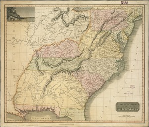
![A map of West Florida and part of Et: Florida, Georgia part of So: Carolina i[n]cluding [torn] & Chactaw, Chickasaw & Creek nations with [torn] [r]oad [torn] Pensacola through ye: Creek nation to Augusitus & Charlestown](https://bpldcassets.blob.core.windows.net/derivatives/metadata/commonwealth-oai:v98001375/image_thumbnail_300.jpg)


30. 1630 shoreline


36. 227 Harzgerode

37. 305 Glatz


39. 4 Kinten

![[A chart of Boston Bay and vicinity]](https://bpldcassets.blob.core.windows.net/derivatives/images/commonwealth:cj82m2976/image_thumbnail_300.jpg)


81. Adriatic


83. Aegyptus Antiqua


94. Africa


96. Africa

97. Africa

98. Africa

99. Africa
