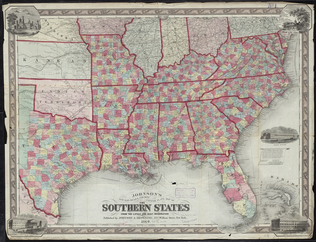
Johnson's new rail road & county copper plate map of the Southern States from the latest and best information
Item Information
- Title:
- Johnson's new rail road & county copper plate map of the Southern States from the latest and best information
- Creator:
- Johnson, A. J. (Alvin Jewett), 1827-1884
- Date:
-
1860
- Format:
-
Maps/Atlases
- Location:
-
Boston Public Library
Norman B. Leventhal Map & Education Center - Collection (local):
-
Norman B. Leventhal Map & Education Center Collection
- Subjects:
-
Counties--Southern States--Maps
Railroads--Southern States--Maps
Southern States--Maps
- Places:
-
Southern United States (area)
- Extent:
- 1 map : hand col. ; 61 x 78 cm.
- Terms of Use:
-
No known copyright restrictions.
No known restrictions on use.
- Publisher:
-
New York :
Johnson & Browning
- Scale:
-
Scale [ca. 1:3,150,000]
- Language:
-
English
- Notes:
-
Entered according to Act of Congress in the year 1859 ...
Relief shown by hachures.
Includes views of Mount Vernon, General Post Office, Patent Office, Smithsonian Institute, and Treasury buildings.
- Identifier:
-
06_01_008780
- Call #:
-
G3860 1860 .J65
- Barcode:
-
39999065657973


