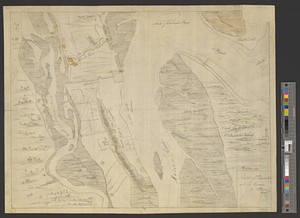
A general map of the southern British colonies in America comprehending North and South Carolina, Georgia, East and West Florida, with the neighbouring Indian countries : from the modern surveys of engineer de Brahm, Capt. Collet, Mouzon & others; and from the large hydrographical survey of the coasts of East and West Florida

This map is also available in American Revolutionary Geographies Online (ARGO), a collections portal especially built for material relating to the American Revolutionary War Era. Visit ARGO to learn more about this item and explore the historical geography of North America in the late eighteenth century.
Item Information
- Title:
- A general map of the southern British colonies in America comprehending North and South Carolina, Georgia, East and West Florida, with the neighbouring Indian countries : from the modern surveys of engineer de Brahm, Capt. Collet, Mouzon & others; and from the large hydrographical survey of the coasts of East and West Florida
- Title (alt.):
-
Seat of war in the southern British colonies comprehending North and South Carolina, Georgia, East and West Florida, &ca.
Plan of Charlestown
Plan of St. Augustine
- Contributor:
- De Brahm, John Gerar William, 1717-approximately 1799
- Contributor:
- Collet, John
- Contributor:
- Mouzon, Henry
- Contributor:
- Robert Sayer and John Bennett (Firm)
- Creator:
- Romans, Bernard, 1741?-approximately 1784
- Name on Item:
-
by B. Romans, 1776
- Date:
-
October 15, 1776
- Format:
-
Maps/Atlases
- Location:
- William L. Clements Library
- Collection (local):
-
William L. Clements Library Collection
- Subjects:
-
Southern States--Maps
Charleston (S.C.)--Maps
Saint Augustine (Fla.)--Maps
United States--History--Revolution, 1775-1783--Maps
- Places:
-
Southern United States (area)
South CarolinaCharleston (county)Charleston
FloridaSaint Johns (county)Saint Augustine
- Extent:
- 1 map : outline col. ; 50.6 x 65.1 cm.
- Terms of Use:
-
The University of Michigan Library provides access to these materials for educational and research purposes. These materials may be under copyright. If you decide to use any of these materials, you are responsible for making your own legal assessment and securing any necessary permission. If you have questions about the collection, please contact the William L. Clements Library.
Contact host institution for more information.
- Publisher:
-
London :
R. Sayer and J. Bennett, no. 53 Fleet Street
- Scale:
-
Scale 1:3,000,000. Scales of insets vary.
- Language:
-
English
- Catalog Record:
-
Catalog record
- Identifier:
-
878
- Barcode:
-
B2640513
![A sketch of St. Augustin [sic] Harbour &c.](https://bpldcassets.blob.core.windows.net/derivatives/metadata/commonwealth-oai:vd670z134/image_thumbnail_300.jpg)