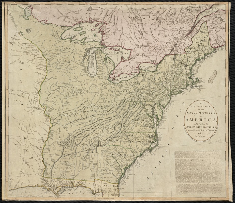
An accurate map of the United States of America, with part of the surrounding provinces agreeable to the Treaty of Peace of 1783
This map is also available in American Revolutionary Geographies Online (ARGO), a collections portal especially built for material relating to the American Revolutionary War Era. Visit ARGO to learn more about this item and explore the historical geography of North America in the late eighteenth century.
Item Information
- Title:
- An accurate map of the United States of America, with part of the surrounding provinces agreeable to the Treaty of Peace of 1783
- Description:
-
Depicts the eastern United States, west to the Mississippi River, and part of the Louisiana territory.
- Creator:
- Cary, John, ca. 1754-1835
- Name on Item:
-
by Ino. Cary.
- Date:
-
1783
- Format:
-
Maps/Atlases
- Location:
-
Boston Public Library
Norman B. Leventhal Map & Education Center - Collection (local):
-
Norman B. Leventhal Map & Education Center Collection
- Subjects:
-
United States--Maps--Early works to 1800
- Places:
-
United States
- Extent:
- 1 map : hand-col. ; 58 x 65 cm.
- Terms of Use:
-
No known copyright restrictions.
No known restrictions on use.
- Publisher:
-
London :
J. Cary
- Scale:
-
Scale not given.
- Language:
-
English
- Notes:
-
Relief shown pictorially.
"Longitude west from London."
Includes text: "Article I, II, III."
- Identifier:
-
06_01_002534
- Call #:
-
G3700 1783 .C37
- Barcode:
-
39999058995414


