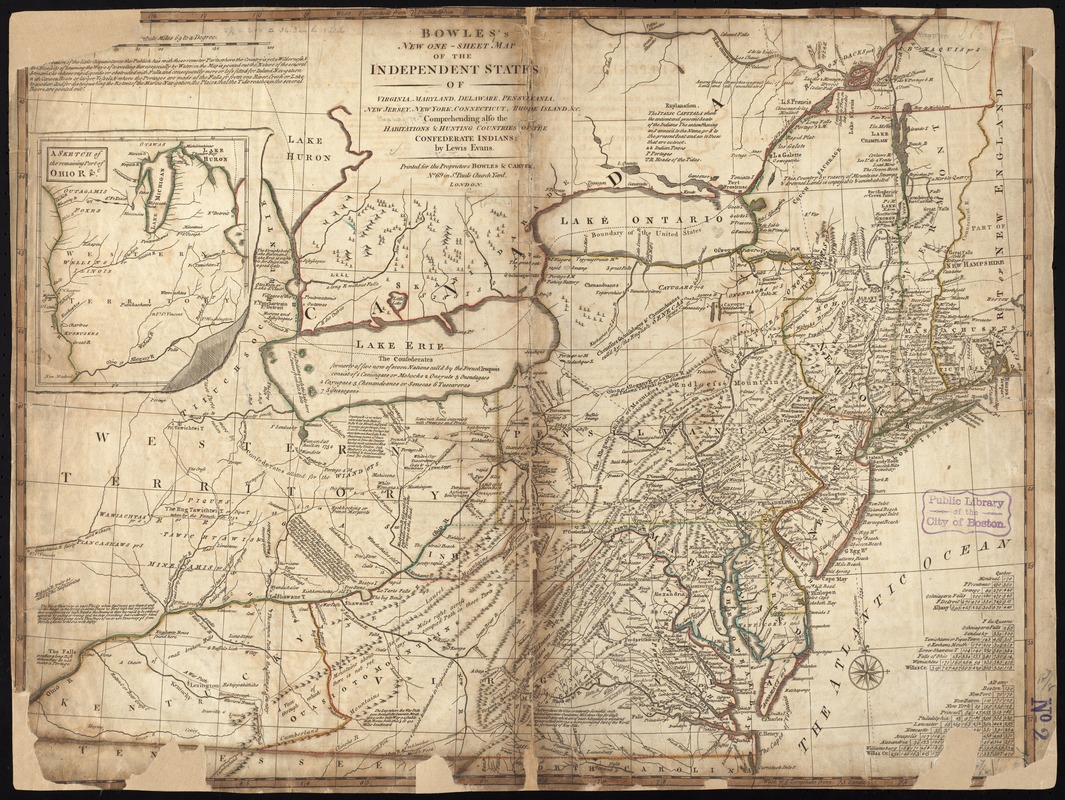
Bowles's new one-sheet map of the independent states of Virginia, Maryland, Delaware, Pensylvania, New Jersey, New York, Connecticut, Rhode Island, &c. comprehending also the habitations & hunting countries of the confederate Indians
This map is also available in American Revolutionary Geographies Online (ARGO), a collections portal especially built for material relating to the American Revolutionary War Era. Visit ARGO to learn more about this item and explore the historical geography of North America in the late eighteenth century.
Item Information
- Title:
- Bowles's new one-sheet map of the independent states of Virginia, Maryland, Delaware, Pensylvania, New Jersey, New York, Connecticut, Rhode Island, &c. comprehending also the habitations & hunting countries of the confederate Indians
- Creator:
- Evans, Lewis, 1700?-1756
- Name on Item:
-
by Lewis Evans.
- Date:
-
[1796]
- Format:
-
Maps/Atlases
- Location:
-
Boston Public Library
Norman B. Leventhal Map & Education Center - Collection (local):
-
Norman B. Leventhal Map & Education Center Collection
- Subjects:
-
United States--Maps--Early works to 1800
- Places:
-
United States
- Extent:
- 1 map : outline col. ; 48 x 63 cm.
- Terms of Use:
-
No known copyright restrictions.
No known restrictions on use.
- Publisher:
-
London :
Bowles & Carver
- Scale:
-
Scale 1:2,300,000.
- Language:
-
English
- Notes:
-
Relief shown pictorially.
Inset: Sketch of the remaining part of Ohio R. &c.
- Notes (date):
-
This date is inferred.
- Identifier:
-
06_01_006216
- Call #:
-
G3700 1796 .E93
- Barcode:
-
39999059021418


